High cross mountain
| High cross mountain | ||
|---|---|---|
|
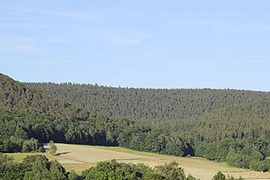
Hoher Querberg (in the background, left of the center of the picture) and human head (in the background, right of the center of the picture) |
||
| height | 474 m above sea level NHN | |
| location | Aschaffenburg district (Bavaria) | |
| Mountains | Spessart | |
| Dominance | 0.65 km → Gaiersberg | |
| Notch height | 5 m | |
| Coordinates | 50 ° 8 ′ 13 ″ N , 9 ° 16 ′ 10 ″ E | |
|
|
||
The Hohe Querberg (formerly: Querberg ) is 474 m above sea level. NHN high mountain in the Spessart in the Bavarian district of Aschaffenburg in Germany .
geography
The Hohe Querberg is the highest elevation in the Huckelheimer Wald , a former community-free forest area between Westerngrund and Kleinkahl . It is bounded in the east by the Habersbach valley . To the west of the summit lies the Arzborn , the source of the Querbach . Its valley stretches in a south-westerly direction to Huckelheim . The Menschenkopf (465 m) adjoins the Hohen Querberg in the south and the Glasberg (476 m) in the northwest . In the north it goes flat to the Gaiersberg (475 m). The state border with Hesse and the historic Birkenhainer Straße trade route run in the gap between the two peaks, about 350 m from that of the Hohe Querberges .

