Glasberg (lentil dish)
| Glasberg | ||
|---|---|---|
|
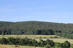
The Glasberg seen from Huckelheim |
||
| height | 476.1 m above sea level NHN | |
| location | Main-Kinzig district (Hesse) | |
| Mountains | Spessart | |
| Dominance | 2.1 km → Franzosenkopf | |
| Notch height | 37 m | |
| Coordinates | 50 ° 8 '25 " N , 9 ° 15' 16" E | |
|
|
||
The Glasberg is 476 m above sea level. NHN high mountain in the Spessart between Biebergemünd and Westerngrund in the Hessian Main-Kinzig district and the Bavarian district of Aschaffenburg in Germany .
geography
The Glasberg lies between Breitenborn / Lützel and Huckelheim . The state border between Bavaria and Hesse runs a little south of the summit. The Lützelbach rises on its northern slopes . The Glasberg goes flat in the east to the mountains Gaiersberg (475 m) and Hoher Querberg (474 m). In a north-westerly direction it is connected to the Franzosenkopf (481 m). The summit itself is located in the district of Großenhausen , a district of the north-western municipality of Linsengericht .
The historic Birkenhainer Straße trade route leads over the Glasberg .

