High Rode
| High Rode | ||
|---|---|---|
|
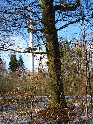
Hohes Rode with Luther oak and telecommunications tower |
||
| height | 493 m | |
| location | Unstrut-Hainich-Kreis , Thuringia | |
| Mountains | Hainich , | |
| Coordinates | 51 ° 11 ′ 41 ″ N , 10 ° 19 ′ 24 ″ E | |
|
|
||
| rock | Shell limestone | |
The Hohes Rode (also Hohe Rode ) is 493 m above sea level. NHN meters the second highest mountain of the Hainich in the Unstrut-Hainich district , Thuringia ( Germany ).
location
The mountain is located on the northern edge of the Hainich in the western part of the Unstrut-Hainich district between the localities Eigenrieden in the north and Heyerode in the south. The district town of Mühlhausen is about eight kilometers to the east.
Natural classification
According to the natural structure in the Kassel sheet, the mountain is part of the Hohen Hainich (no. 483.50) within the Hainich natural area (no. 483.5) of the north-western edge of the Thuringian basin (no. 483). According to the structure within Thuringia ( The Natural Spaces of Thuringia ), it is assigned to the Hainich-Dün-Hainleite unit.
nature
The completely forested mountain (mainly mixed beech forests) is the highest point in northern Hainich. In the transition area to the Upper Eichsfeld there is an unnamed mountain (483.1 m) in the west and the Auf der Burg (489.1 m) elevation in the north . In the south, the valley of the Seebachgrund ends with a depression called Tiefes Rode . The entire mountain area is made accessible by numerous hiking trails, including the Rennstieg . This is also where the Mühlhausen Landgraben begins to protect the former free imperial city of Mühlhausen.
The mountain is located in the Eichsfeld-Hainich-Werratal Nature Park and is part of the following protected areas:
- LSG Mühlhäuser Stadtwald
- FFH area Hainich
- VSG Hainich
particularities
A tower that was visible from afar was located on the summit plateau from 1981 (construction started) until it was demolished in 1995. It served the Soviet armed forces for radio reconnaissance (no radar system) and was therefore also called Cafe Moscow , among others . Today there is a telecommunications tower there.
Individual evidence
- ↑ Gender not finally clarified, but probably neuter
- ↑ Map services of the Federal Agency for Nature Conservation ( information )
- ↑ Hans-Jürgen Klink: Geographical land survey: The natural space units on sheet 112 Kassel - Federal Institute for Regional Studies, Bad Godesberg 1969 → online map
-
^ Walter Hiekel, Frank Fritzlar, Andreas Nöllert and Werner Westhus: The natural spaces of Thuringia . Ed .: Thuringian State Institute for Environment and Geology (TLUG), Thuringian Ministry for Agriculture, Nature Conservation and Environment . 2004, ISSN 0863-2448 . → Natural area map of Thuringia (TLUG) - PDF; 260 kB → Maps by district (TLUG)

