
Holstenstrasse (Hamburg)
| Holstenstrasse | |
|---|---|
|
|
|
 |
|
| Holstenstrasse in a southerly direction at the level of the Holsten brewery | |
| Basic data | |
| place | Hamburg |
| District | Altona-Altstadt , Altona-Nord |
| Created | 16th century or earlier |
| Newly designed | 1830s (inclusion of the Pinneberger Weg) 1960s (extension to the Nobistor) |
| Connecting roads | Pepermölenbek (south), Kieler Strasse (north) |
| Cross streets | Königstrasse, Reeperbahn , Nobistor, Louise-Schroeder-Strasse, Simon-von-Utrecht-Strasse, Scheplerstrasse, Gählerstrasse, Govertsweg, Chemnitzstrasse, Thadenstrasse, Karl-Wolff-Strasse, Norderreihe, Max-Brauer-Allee, Zeiseweg, Suttnerstrasse, Holstenplatz, Eggerstedtstrasse, Haubachstrasse, Stresemannstrasse |
| use | |
| User groups | Car traffic , pedestrian traffic , bicycle traffic , public transport |
| Technical specifications | |
| Street length | 1700 meters |
The Holsten Street is a street in Hamburg-Altona . It has been running from the western end of the Reeperbahn at Nobistor in a north-westerly direction since the 1960s and after 1.7 kilometers, at the Stresemannstrasse intersection, it becomes Kieler Strasse. The street is an important traffic axis between the Hamburg city center north of the Elbe bank and the north-western parts of the city.
Surname
The Holstenstraße was the local road that leads to Holstein and is named after the Saxon tribe of the Holsten or Holsaten (Waldsassen, forest dwellers) who previously lived there . On a map from 1890 it is entered as Holsteinstrasse . Until 1846, and partly also in later years, it was called Pinneberger Straße , but it is also more comprehensively registered than Bei dem Pinneberger Weg . Around 1800 it was called Pinneberger Weg , previously it was called Pinneberger Landstrasse .
history
The origins of the Holstenstraße go back to the founding time of Altona, it was the country road that led into the county of Holstein-Pinneberg and was accordingly called Pinneberger Landstraße . Until the end of the 17th century, it began on the Große Bergstraße , which was then on the outskirts of the city , opposite the confluence of the former Kleine Bergstraße east of the Jewish cemetery . This roughly corresponds to the current confluence of Nobistor with Louise-Schroeder-Straße. The Pinneberger Landstrasse led in an arch past the Franschen Hof and further on the Lang Land on the western side and on the Eifflers Feld and Lammers Kamp on the eastern side and continued northwest towards the thief pond .
After Hans Christian Eiffler had become mayor of Altona in 1680, the decision was made to use his land, Eifflers Feld , for the necessary city expansion and to create streets and alleys. The Pinneberger Landstrasse was relocated for the construction of Johannisstrasse, it now began at Rosenstrasse and the junction with Johannisstrasse. Your first section of the route was called Bey dem Franschen Hof and was roughly at the level of the current confluence of Gählerstrasse and Holstenstrasse.

When the Altona-Kieler Chaussee was built between 1830 and 1832, what was then Pinneberger Weg was included as the southern section. The zero point of this art street was a square with a roundabout of garden art , which was laid out in 1833 after the Johannisstrasse had been straightened in the crossing area at Franschen Hof, a few years later called Gählers Platz. From here the postillions, stagecoaches and other wagons left for Kiel . With the opening of the Chaussee on January 1, 1832, the length of the route was reduced from 14 to 12 ¼ miles , which corresponded to a shortening of about 13 kilometers .
In the course of the 19th century, the city grew to a dense development, the former country road became the densely populated inner-city area of the Altona / Elbe, which was independent until 1938. During the Second World War , this inner city core of the old town was almost completely destroyed, and in the 1950s the remains of the historic buildings were demolished. In their place, analogous to the Neu-Altona plan, there was a loosened up development with point high-rise buildings and row-shaped apartment buildings on both sides. This resulted in a fundamental restructuring of the area with the relocation of roads and land. The Holstenstraße was extended to include the southern and largest part of the street Kleine Freiheit as far as the Nobistor - today, following renovations, it is adjacent to the Reeperbahn.
From Max-Brauer-Allee to the Hamburg-Altonaer connecting railway , Holstenstrasse forms the border between the districts of Altona-Altstadt and Altona-Nord .
course


From the Königstraße / Reeperbahn intersection, Holstenstraße runs as a four-lane street in a north-westerly direction; south of this intersection, it has a direct connection to the Altona fish market and the Hafenrandstrasse on the northern bank of the Elbe via the two-lane Pepermölenbek road . The course of the street consists of larger intersections with Louise-Schroeder-Straße / Simon-von-Utrecht-Straße, Chemnitzstraße / Thadenstraße, Max-Brauer-Allee and the confluences of Eggerstedt- and Haubachstraße opposite Holstenplatz. At its end, it is bridged by a long-distance and suburban railway line and ends at an intersection with Stresemannstrasse. Your continuation out of town exists in the Kieler Straße.
As far as Holstenplatz, Holstenstraße is part of the so-called Ring 2 , a street layout that surrounds the outer city center in a semicircle.
Buildings and peripheral areas
Along the southern part of the western side is the Walter-Möller -Park , which is connected to the Emil-Wendt-Park (formerly Gählerpark ) on the eastern side by a pedestrian bridge . Both parks are part of the so-called Grünzug Neu-Altona , more or less wide green strips through which footpaths and cycle paths lead from the fish market to the Holstenbahnhof. A section of the Walter Möller Park on Holstenstrasse was built over in 2009/2010 with the mainland indoor swimming pool from Bäderland Hamburg GmbH. At the northern end, in house number 224, has been available since 1879/1880 on the west side the premises of Holsten brewery .
Transport links
Development of local public transport

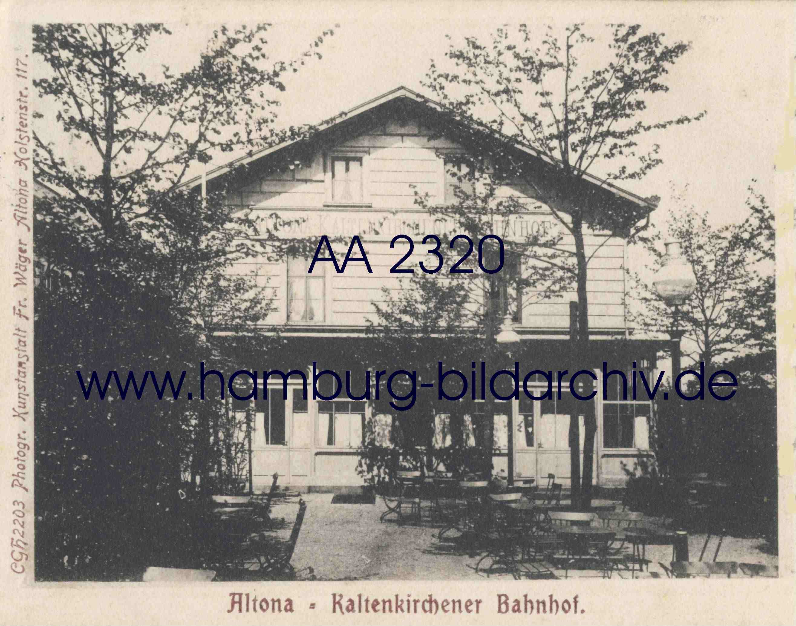
On November 24, 1884, the first Kaltenkirchen train station at Gählersplatz was put into operation by the Altona-Kaltenkirchener Eisenbahn-Gesellschaft (AKEG, from 1914 Eisenbahn-Gesellschaft Altona-Kaltenkirchen-Neumünster AKN). The route led at street level via the Nebenzollamt station to Kaltenkirchen. At Gählersplatz there was a connection to tram line 29 of the Hamburg Altona North Western Tramway Co. (HANWTC, from 1900 Hamburg-Altonaer Trambahngesellschaft), which opened in 1883 and ran from the Allee intersection via Holstenstraße, Große Rosenstraße (today Paul-Roosen-Straße) to Millerntor led. With the expansion of the connecting line in 1893, the operation of the AKEG-Bahn on the Gählersplatz section to the Nebenzollamt station (from 1898 Bramstedter station) at the end of Holstenstrasse was discontinued and tram line 29 was extended to the newly built Holstenstrasse station. In 1912 the AKEG route was moved from the Chaussee to its own subgrade, it now ended at Sonderburg Platz , today's Kaltenkircher Platz, where a new Kaltenkirchen train station was built as a terminus.
Today's local public transport
The S-Bahn station Holstenstraße , served by the S-Bahn lines S 21 and S 31, and at times also by the S 11, is not directly on the street, but on Holstenplatz about 100 meters away. At the other end of the street, in the Reeperbahn / Königstraße intersection, there is an entrance to the tunnel station of the Reeperbahn S-Bahn station with lines S 1, S 3 and line S2, which runs at peak times.
The entire course of Holstenstrasse is traversed by the bus line 283 operated by the elevated railway with five stops. Buses 20, 25 and 183 also run between the Max-Brauer-Allee intersection and the Holstenstraße S-Bahn station.
Web links
- Volker Woesner: The Kiel - Altonaer Chaussee from 1832
- Kaltenkirchen train station at the secondary customs office around 1900
- Holstenstrasse on the Falkplan 1947
Individual evidence
- ↑ Christian Hanke: Hamburg's street names tell a story. Hamburg 2006, ISBN 3-929229-41-2 , p. 20
- ↑ a b Library system University of Hamburg: Altona in the year 1836. Taken under Etatrath Schumacher's direction and drawn by Capitain Nyegaard.
- ↑ Library System University of Hamburg: CLB Mirbeck. B. Baker Sculp. Islington, 1803 map
- ^ A b Niels Nikolaus Falck: New citizenship magazine with special regard to the duchies of Schleswig, Holstein and Lauenburg , Volume 5, 1835, p. 406 .
- ↑ Grünzug Neu-Altona ( Memento of the original dated December 31, 2012 in the Internet Archive ) Info: The archive link was inserted automatically and has not yet been checked. Please check the original and archive link according to the instructions and then remove this notice.
- ↑ a b Lokrundschau: 125 years Altona-Kaltenkirchen-Neumünster Eisenbahn AG , accessed on January 23, 2010
- ↑ Lines in the area of Allee and Holstenstraße , accessed on January 23, 2011
Coordinates: 53 ° 33 ′ 12 " N , 9 ° 57 ′ 15" E