Hombach (Ochtum)
| Hombach | ||
|
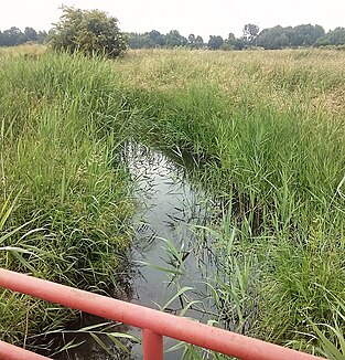
The Hombach just before the mouth |
||
| Data | ||
| Water code | EN : 4924 | |
| location | District of Diepholz , Lower Saxony | |
| River system | Weser | |
| Drain over | Ochtum → Weser → North Sea | |
| source | northeast of Bassum 52 ° 51 ′ 23 " N , 8 ° 45 ′ 14" E |
|
| Source height | 42 m above sea level NN | |
| muzzle | north-east of Brinkum in the Ochtum Coordinates: 53 ° 1 ′ 15 " N , 8 ° 49 ′ 19" E 53 ° 1 ′ 15 " N , 8 ° 49 ′ 19" E |
|
| Mouth height | 4 m above sea level NN | |
| Height difference | 38 m | |
| Bottom slope | 1.6 ‰ | |
| length | 23.4 km | |
| Communities | Bassum , Stuhr , Weyhe | |
The Hombach is part of the Weser river system . It has a length of 23.4 km and rises northeast of Bassum .
It flows exclusively in the district of Diepholz ( Lower Saxony ) through the towns of Bassum- Nordwohlde , Stuhr -ahrenhorst and Weyhe -Leeste. Here the Gänsebach flows in from the right. From here it flows on as Leester Mühlenbach until it flows into the Ochtum northeast of Brinkum , south of Bremen-Obervieland .
Right-hand tributaries are the Finkenbach (about 10 km long, tributary south of Nordwohlde) and the Gänsebach (7 km long, tributary in Leeste).
Today there is no watermill on his way . From 1393 to 1960 there was a watermill in Leeste, on Leester Strasse.
The responsible water and soil association is the WBV Hache and Hombach.
