Homert (Ebbegebirge)
| Homert | ||
|---|---|---|
| height | 538.3 m above sea level NHN | |
| location | Sauerland , Märkischer Kreis , North Rhine-Westphalia ( Germany ) | |
| Mountains | Ebbe Mountains | |
| Coordinates | 51 ° 10 ′ 40 " N , 7 ° 38 ′ 42" E | |
|
|
||
| particularities | Location of the Homert Tower | |
The Homert is 538.3 m above sea level. NHN high mountain of the Ebbegebirge in the western part of the Sauerland in the Märkisches Kreis , North Rhine-Westphalia ( Germany ).
Geographical location
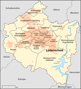
The Homert rises in the northern Griesing Ridge , a north-western foothill of the Ebbegebirge, on the northwestern edge of the Ebbegebirge Nature Park . It is the highest mountain in the Lüdenscheid urban area, the city center of which is about 4.5 km north. Herscheid is 7 km east, Meinerzhagen and Kierspe are on average about 7.2 km south and Halver is 10.5 km (depending on the beeline ) west.
The federal motorway 45 runs on the eastern slope of the Homert ; Beyond that, the Versetalsperre with the forest nature trail extends to the Hokühler Bay . About 450 meters south of the mountain summit stems from the Jubach, the slightly southwest lying Jubachtalsperre as Volme flows through influx. The hamlet of Homert is about 300 m southeast of the summit.
tourism
The " Homert Tower " observation tower built on the Homert provides a wide view over the Sauerland to the borders of the Ruhr area . The SGV hut “An der Homert” and the “Fritz Kaether hut” are at its foot .
The hiking trails offer opportunities for walks and hikes , for example to the aforementioned reservoirs. The hiking trail crossing, a few meters north of Homert, is 530.1 m above sea level.
Individual evidence
- ↑ a b Topographical Information Management, Cologne District Government, Department GEObasis NRW ( Notes )
