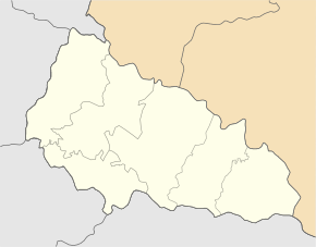
Hruschovo
| Hruschovo | ||
| Грушово | ||

|
|
|
| Basic data | ||
|---|---|---|
| Oblast : | Zakarpattia Oblast | |
| Rajon : | Tyachiv Raion | |
| Height : | 241 m | |
| Area : | 4.028 km² | |
| Residents : | 5,897 (2004) | |
| Population density : | 1,464 inhabitants per km² | |
| Postcodes : | 90570 | |
| Area code : | +380 3134 | |
| Geographic location : | 48 ° 0 ' N , 23 ° 46' E | |
| KOATUU : | 2124482001 | |
| Administrative structure : | 1 village | |
| Address: | вул. Леніна 93 90 570 с. Грушово |
|
| Statistical information | ||
|
|
||
Hruschowo ( Ukrainian Грушово ; Russian Грушево Gruschewo , Slovak Hrušovo , Hungarian Szentmihálykörtvélyes ) is a village in the south of the Ukrainian Zakarpattia Oblast on the Romanian border with about 5900 inhabitants (2004).
The village, first mentioned in writing in 1390, is located in the historical region of Maramureș . It forms an independent district council in the south of Tyachiv Rajon .
Hruschowo is located at the mouth of the Apschyzja ( Апшиця ) in the Tisza and on the road N 09 near the village of Nyschnja Apscha . The Rajon center of Tyachiv is 17 km to the west and the Uzhhorod oblast center is 155 km to the north-west of Hruzhovo. Hruschowo has a train station on the Tereswa – Velykyj Bychkiv railway line .
Individual evidence
- ↑ Hruschowo on the official website of the Verkhovna Rada , accessed on June 9, 2015
- ↑ Cities and Villages in the Transcarpathian-Hruschowo Region , accessed on June 9, 2015

