Huasca de Ocampo
| Huasca de Ocampo | ||
|---|---|---|
|
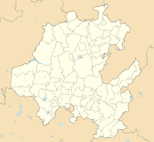
Coordinates: 20 ° 12 ′ N , 98 ° 35 ′ W Huasca de Ocampo on the map of Hidalgo
|
||
| Basic data | ||
| Country | Mexico | |
| State | Hidalgo | |
| Municipio | Huasca de Ocampo | |
| Residents | 538 (2010) | |
| City insignia | ||
| Detailed data | ||
| height | 2105 m | |
| Time zone | UTC −6 | |
| Huasca de Ocampo - town center | ||
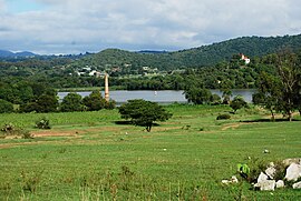
| Area with San Antonio reservoir | ||
| Gorge with basalt columns and waterfall | ||
Huasca de Ocampo is a village with a good 500 inhabitants and the capital of a municipality ( municipio ) with about 17,000 inhabitants in the southeast of the Mexican state of Hidalgo . Because of its colonial center and the charming landscape, the place is one of the first pueblos Mágicos in Mexico.
location
Huasca de Ocampo is located in a valley surrounded by mountains about 130 km (driving distance) northeast of Mexico City at an altitude of about 2100 m above sea level. d. M. Pachuca de Soto , the state capital, is located approximately 31 km southwest.
Population and economy
Only a small part of the community's residents speak the regional Nahuatl dialect; Colloquial language is mostly Spanish. Until the 20th century there were several silver ore mines in the area ; agricultural production was mainly in the hands of large landowners ( hacienderos ). Corn, beans and vegetables are grown in the fields; there are also extensive pastures. Small craft workshops and shops sprang up in the scattered villages.
history
There are no pre-Spanish buildings or ruins in the region, which is only about 100 km (as the crow flies) from the coast of the Gulf of Mexico . There are some colonial buildings in the center of the village. In the area, a few haciendas were built in the 18th century , which were mainly dedicated to silver ore mining and only farmed to a small extent. All of this largely collapsed during the Mexican War of Independence (1810-1821), and even after that the mining industry remained at a low level. At the beginning of the 20th century, the place was nicknamed the political reformer Melchor Ocampo (1814–1861).
Attractions
- The alleys and houses of the small historical center of the place convey a colonial atmosphere. Most of the buildings are made of volcanic lava rock; their facades were then plastered and painted in color. Some have or had elongated wooden balconies in the Andalusian style.
- The Iglesia de San Juan Baptista is a single-nave building with plastered barrel vaults and brick arches ; There are several simple altarpieces on the walls . Its simple arched portal shows a few precisely hewn stones; in the field above there is a relief figure of an angel with a helmet, breastplate , gauntlet boots and a martyr's palm .
- A curiosity is a small museum ( Museo de los Duendes ), which is dedicated to knotted and braided horse manes.
- Surroundings
- The remains of several haciendas can be found in the charming, mostly green area all year round, which were mainly used for silver ore mining. One of them was swallowed up by the water during the construction of the San Antonio Dam - only the top of the church tower and a chimney stick out of the water.
- A waterfall in a ravine ( Barranca de Alcholoya ) with volcanic basalt column formations ( Prismas Basálticos ) is a popular destination.
- Nearby are the notable Haciendas Santa María Regla and San Miguel Regla , which have been converted into hotels . The former was already visited by Alexander von Humboldt in 1803.


