Hurrungane
| Hurrungane | ||
|---|---|---|
|
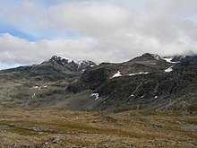
Summit in Hurrungane in a snowy state, seen from the "Storen": Store Ringstind ( 2124 m ) on the left and Store Austanbotntind ( 2204 m on the right) |
||
| Highest peak | Store Skagastølstind ( 2405 moh. ) | |
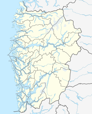
| location | Vestland ( Norway ) | |
| part of | Jotunheimen | |
|
|
||
| Coordinates | 61 ° 24 ' N , 7 ° 45' E | |
A mountain group in the southwestern Jotunheimen Mountains is known as the Hurrungane . The area extends east of the innermost foothills of the Sognefjord , the Lustrafjord and the Årdalsfjord. To the north it is bounded by Sognefjell and to the south-east by the deeply cut Utladalen. Hurrungane lies within the municipalities of Luster and Årdal and is part of the Jotunheimen National Park . To the south of Hurrungane is the village of Øvre Årdal. The road from Øvre Årdal to Turtagrø in the north is the only road connection.
landscape
Hurrungane is characterized by a high alpine, rugged landscape with numerous glaciers and mountain lakes. 25 peaks reach a height of more than 2000 m . The six highest mountains in Hurrangane are Store Skagastølstind, or “Storen” for short ( 2469 m ), Nordre Skagastølstind ( 2167 m ), Styggedalstind ( 2387 m ), Gjertvasstind ( 2351 m ), Sentraltind ( 2348 m ) and Austanbotntind ( 2204 m ). These peaks are z. T. very popular with climbers. The area is above the tree line; therefore prevail lichens , mosses and wet locations cotton grass before. Due to the exposed location (Hurrungane is the first high mountain range east of the fjord inland) there is abundant rainfall.
geology
Hurrungane is part of the Jotund nappa complex and consists essentially of highly metamorphic rocks ( gneiss , granulites , amphibolites ) from the Precambrian , which were pushed onto the Baltic Shield during the Caledonian orogeny in the Silurian / Devonian . In this context, pegmatites appear in several places , which have a very broad spectrum of minerals.
See also
literature
- ↑ http://www.scandinavianmountains.com/areas/01-hurrungane/index.htm
- ^ Koestler AG (1983): Central complex and north-west edge zone of the Jotundecke, West-Jotunheimen, Southern Norway. Structural geology and geochronology. Messages from the Geological Institute of the ETH and the University of Zurich, new series 242, 1-225.
- ^ Koestler AG (1989): Hurrungane 1517 IV, bergrunnskart (geological map) 1:50 000. Norsk Geologisk Undersøkelse, Trondheim
- ↑ Selbekk RS, Spürgin S. & Lundmark AM (2006): Beryll-allanitt- (Ce) pegmatittene i Berdalen, Hurrungane. Stone 33, no. 1, 28-31. (in Norwegian)


