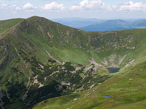
Hutyn Tomnatyk
|
Hutyn Tomnatyk Гутин Томнатик |
||
|---|---|---|
|
Hutyn Tomnatyk with Lake Brebeneskul |
||
| height | 2016 m | |
| location |
Zakarpattia Oblast , Ukraine |
|
| Mountains | Carpathian Mountains , Chornohora | |
| Coordinates | 48 ° 6 '0 " N , 24 ° 33' 24" E | |
|
|
||
| rock | Flysch | |
The Hutyn Tomnatyk ( Ukrainian Гутин Томнатик , Russian Гутин Томнатек Gutin Tomnatek ) is a 2,016 m high mountain in the southern foothills of the main ridge of the " Black Mountains ", the highest mountain range of the Carpathians in the Ukrainian Zakarpattia Oblast .
The in Carpathian Biosphere Reserve located Zweitausender has an alpine and subalpine vegetation and there are glacial landforms.
Between the Hutyn Tomnatyk and the Brebeneskul to the east is the Brebeneskul Lake , the highest lake in Ukraine , at 1801 m above sea level .
Individual evidence
- ^ Institute of Natural Sciences, Geography and Natural History - The highest peaks of the Ukrainian Carpathians and their geomorphological regions , accessed on January 11, 2015. (Ukrainian)
- ↑ Ukrainian Carpathians - Hutyn Tomnatyk on karpaty.com.ua , accessed on January 11, 2015
- ↑ The ten highest mountains in Ukraine on karpaty.ua , accessed on January 11, 2015

