Ib (river)
| Ib | ||
|
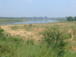
Ib near Jharsuguda |
||
| Data | ||
| location | Chhattisgarh , Odisha ( India ) | |
| River system | Mahanadi | |
| Drain over | Mahanadi → Indian Ocean | |
| Headwaters | near Pandraput 23 ° 6 '15 " N , 83 ° 42' 5" O |
|
| Source height | approx. 1000 m | |
| muzzle |
Hirakud Dam Coordinates: 21 ° 49 ′ 18 ″ N , 83 ° 56 ′ 39 ″ E 21 ° 49 ′ 18 ″ N , 83 ° 56 ′ 39 ″ E |
|
| Mouth height | approx. 190 m | |
| Height difference | approx. 810 m | |
| Bottom slope | approx. 3.2 ‰ | |
| length | 252 km | |
| Catchment area | 12,447 km² | |
| Left tributaries | Safei, Bheden | |
| Right tributaries | Maini, Khorung, Ichha | |
| Medium-sized cities | Sundargarh | |
The Ib is a left tributary of the Mahanadi in the Indian states of Chhattisgarh and Odisha .
The river has its source near the village of Pandraput in the Jashpur district in the northeast of Chhattisgarh. The Ib flows mainly in a southerly direction. He passes the Gullu waterfall . At the confluence of the Maini , the river is dammed by the Thethetangar dam . River water is diverted via an irrigation canal. The Ib continues its course south. It flows past the city of Sundargarh . The Bheden flows into the river on the left. Finally, it flows 8 km west of the city of Jharsuguda into the reservoir of the Hirakud Dam . The Ib has a length of 252 km. It drains an area of 12,447 km².
The Ib train station is nearby.
Web links
Commons : Ib - collection of images, videos and audio files
