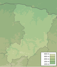
Ikwa (Styr)
|
Ikwa Іква |
||
|
The Ikwa in Dubno |
||
| Data | ||
| location | Ukraine → Lviv Oblast , Rivne Oblast | |
| River system | Dnepr | |
| Drain over | Styr → Prypiat → Dnieper → Black Sea | |
| source | near Chernytsia , Brody Raion 49 ° 57 ′ 56 ″ N , 25 ° 13 ′ 45 ″ E |
|
| Source height | 314 m | |
| muzzle | near Torhowyzja , Mlyniv district Coordinates: 50 ° 33 '50 " N , 25 ° 23' 46" E 50 ° 33 '50 " N , 25 ° 23' 46" E
|
|
| length | 155 km | |
| Catchment area | 2250 km² | |
| Left tributaries | Lypka | |
| Right tributaries | Samez , Lyudomyrka , Tartachka | |
| Medium-sized cities | Dubno | |
| Small towns | Mlyniw | |
| Communities | Velyki Bereschzi , Werba | |
The Ikwa (Ukrainian Іква ) is a 155 km long, right tributary of the Styr in western Ukraine with a catchment area of 2250 km².
The Ikwa rises at an altitude of 314 m near the village of Chernytsia in Brody Raion . It then flows through the Rajone Ternopil and Kremenets in the Lviv Oblast and Raion Dubno of Rivne Oblast before at Torhowyzja in Rajon Mlyniv empties into the Styx. On its bank lies the city of Dubno and the urban-type settlement Mlyniv .
The river has a width of 5 to 25 meters, a depth of 0.5 to 2.2 m and a gradient of 0.89 m / km. The average water flow is 5.5 m³ per second, the maximum water flow is 77 m³ per second. The current speed of the Ikwa at Dubno is 0.5 m per second.
Their water is used for irrigation and water supply.
Tributaries
From the left:
- Lypka ( Липка ), 12 km long, catchment area 85.2 km²
From the right:
- Samez ( Самець ), ~ 7 km long
- Lyudomyrka ( Людомирка ), 20 km
- Tartachka ( Тартачка ), 42 km long, catchment area 386 km²
Course of the Ikwa in the Rivne (light) Oblast and the Lviv Oblast |
Individual evidence
- ↑ Entry on the river in the Encyclopedia of Modern Ukraine ; accessed on June 18, 2017 (Ukrainian)
- ↑ Sights in Ukraine - The Ikwa River on zabytki.in.ua ; accessed on June 18, 2017 (Ukrainian)
- ↑ Entry on Ikwa in the Ukrainian Soviet Encyclopedia ; accessed on June 18, 2017 (Ukrainian)


