Illinois River (Rogue River)
| Illinois River | ||
|
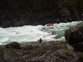
Rafting through the Green Wall Rapids on the Illinois River |
||
| Data | ||
| Water code | US : 1143993 | |
| location | Oregon (USA) | |
| River system | Rogue River | |
| Drain over | Rogue River → Pacific Ocean | |
| Confluence of |
East Fork and West Fork Illinois Rivers 42 ° 9 ′ 35 " N , 123 ° 39 ′ 33" W. |
|
| Source height | 387 m | |
| muzzle | in the Rogue River coordinates: 42 ° 33 '0 " N , 124 ° 3' 58" W 42 ° 33 '0 " N , 124 ° 3' 58" W. |
|
| Mouth height | 32 m | |
| Height difference | 355 m | |
| Bottom slope | 3 ‰ | |
| length | 120 km | |
| Catchment area | 2546 km² | |
| Discharge at the gauge at Kerby Location: 81 km above the mouth |
MNQ MQ MHQ |
3 m³ / s 36 m³ / s 2611 m³ / s |
| National Wild and Scenic River | ||
| East Fork Illinois River | ||
| Water code | US : 1141571 | |
| location | Oregon (USA) | |
| River system | Rogue River | |
| Drain over | Illinois River → Rogue River → Pacific Ocean | |
| source | in Curry County 41 ° 52 ′ 58 " N , 123 ° 36 ′ 43" W. |
|
| Association with |
West Fork to the Illinois River 42 ° 9 ′ 35 " N , 123 ° 39 ′ 33" W. |
|
| Mouth height |
387 m
|
|
| West Fork Illinois River | ||
|
West Fork of the Illinois River, south of O'Brien, Oregon |
||
| Data | ||
| Water code | US : 1152083 | |
| location | Oregon (USA) | |
| River system | Rogue River | |
| Drain over | Illinois River → Rogue River → Pacific Ocean | |
| source | in Curry County 41 ° 59 ′ 28 ″ N , 123 ° 45 ′ 52 ″ W. |
|
| Association with |
East Fork to the Illinois River 42 ° 9 ′ 35 " N , 123 ° 39 ′ 33" W. |
|
| Mouth height |
387 m
|
|
The Illinois River is a 120 km long tributary of the Rogue River .
The river rises in two arms, the East Fork Illinois River and West Fork Illinois River , in the Siskiyou Mountains in Northern California, immediately on the Oregon border, before they meet at Cave Junction in Josephine County , Oregon. It flows into the Rogue River. The Illinois River flows in a predominantly northwestern direction along the western flank of the Klamath Mountains . Both headwaters and the Illinois River predominantly run in the Rogue River - Siskiyou National Forest .
80 km of the river route is marked as a National Wild and Scenic River .
Web links
Individual evidence
- ^ A b East Fork Illinois River in the Geographic Names Information System of the United States Geological Survey
- ^ Illinois River in the Geographic Names Information System of the United States Geological Survey
- ^ West Fork Illinois River in the Geographic Names Information System of the United States Geological Survey
- ↑ National Wild & Scenic Rivers - Illinois River

