Ilo (Peru)
| Ilo | ||
|---|---|---|
|
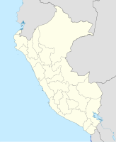
Coordinates: 17 ° 39 ′ S , 71 ° 20 ′ W Ilo on the map of Peru
|
||
| Basic data | ||
| Country | Peru | |
| region | Moquegua | |
| province | Ilo | |
| Residents | 66,118 (2017) | |
| City insignia | ||
| Detailed data | ||
| height | 15 m | |
| Time zone | UTC -5 | |
| City Presidency | Gerardo Felipe Carpio Diaz (since 2019) | |
| Website | ||
| Ilo | ||
Ilo is a port city in southern Peru . The capital of the province of Ilo is in the Moquegua region . 66,118 inhabitants live in Ilo (as of October 2017). Ten years earlier the population was 63,030.
Location and cityscape
Ilo is located on the Pacific , 1,080 kilometers southeast of the Peruvian capital Lima , and is connected to the important Panamericana highway . It consists of seven districts:
- El Puerto
- Villa del Mar
- Ciudad Nueva
- Miramar
- Marítimos
- Alto Ilo
- Pampa Inalámbrica
El Puerto is the commercial center of Ilos, where most of the markets, shops, hotels and restaurants are located. Ciudad Nueva is a former settlement that housed the workers of the Southern Copper . However, the apartments have now become privately owned. Alto Ilo and the Pampa Inalámbrica are the result of growing immigration, mainly from the rural area and the Peruvian Andean region , the Sierra . The Pampa Inalámbrica , in particular , has received enormous numbers of visitors since the 2000s and is now the largest district in terms of both population and area.
economy
The economy of Ilos is strongly influenced by mining. The main employer is Southern Copper , which operates a smelter and refinery north of the city. These are supplied with copper ore via their own railway line from the Toquepala and Cuajone opencast mines . The pure copper is then transshipped and shipped via the port. In addition to mining, fishing (mainly anchovies ) and the processing industry (especially fish meal ) are important.
Infrastructure
The port of Ilo is an important transport hub. In the city is the Mariscal Domingo Nieto stadium . The transoceanic connecting road Transoceánica , which is currently under construction, will lead from São Paulo in Brazil via the Brazilian state of Acre and Bolivia to Ilo.
Attractions
Some of the city's attractions include:
- San Jerónimo Church, 1871
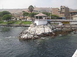
- Glorieta José Gálvez, 1915
- State Pier, 19th century
Ocean port for Bolivia
In a treaty from 1992, Peru and Bolivia agreed that Bolivia could use a 5-kilometer stretch of coast near Ilo as a port. This non-sovereign access to the Pacific for 99 years should make it possible, according to an agreement between the presidents of both countries in October 2010, that Bolivia can call itself a nation on the Pacific Ocean . Peru wants to make port facilities available to the neighboring country and allow free access for imports and exports.
Web links
Individual evidence
- ↑ a b Peru: Moquegua Region - Provinces & Places . www.citypopulation.de. Retrieved December 23, 2019.
- ↑ Instituto Nacional de Estadística e Informática (INEI): Directorio Nacional de Centros Poblados - Censos Nacionales 2017 . Lima 2018, Vol. 4, p. 1457 ( online ).
- ↑ Peru grants Bolivia access to the Pacific , in FAZ of October 20, 2010


