Indrois
| Indrois | ||
|
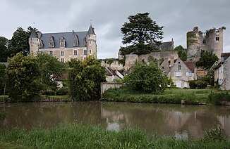
The river in front of the Montrésor Castle |
||
| Data | ||
| Water code | FR : K74-0300 | |
| location | France , Center-Val de Loire region | |
| River system | Loire | |
| Drain over | Indre → Loire → Atlantic Ocean | |
| source | in the municipality of Préaux 47 ° 0 ′ 44 ″ N , 1 ° 19 ′ 59 ″ E |
|
| Source height | approx. 160 m | |
| muzzle | in the municipality of Azay-sur-Indre in the Indre coordinates: 47 ° 12 ′ 38 " N , 0 ° 56 ′ 49" E 47 ° 12 ′ 38 " N , 0 ° 56 ′ 49" E |
|
| Mouth height | approx. 60 m | |
| Height difference | approx. 100 m | |
| Bottom slope | approx. 1.6 ‰ | |
| length | approx. 61 km | |
| Right tributaries | Tourmente , Olivet | |
| Reservoirs flowed through | Etang d'Igneray , Plan d'Eau de Chemillé | |
The Indrois is a river in France that runs in the Center-Val de Loire region . It rises in the municipality of Préaux , generally drains in a north-westerly direction and flows into the Indre as a right tributary after around 61 kilometers in the municipality of Azay-sur- Indre . On his way he crosses the departments of Indre and Indre-et-Loire .
Places on the river
- Préaux
- Loché-sur-Indrois
- Villeloin-Coulangé
- Montrésor
- Chemillé-sur-Indrois
- Genillé
- Saint-Quentin-sur-Indrois
- Chédigny
- Azay-sur-Indre
