Yoke tip
| Yoke tip | ||
|---|---|---|
|
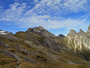
Jochspitze with northern and southern Höllhorn from Kanzberg |
||
| height | 2232 m | |
| location | Border Bavaria , Germany / Tyrol , Austria | |
| Mountains | Höfats and Rauheck Group , Allgäu Alps | |
| Dominance | 0.9 km → Little Wilder | |
| Notch height | 136 m ↓ Lechler Kanz | |
| Coordinates | 47 ° 21 ′ 15 ″ N , 10 ° 23 ′ 0 ″ E | |
|
|
||
| First ascent | local people | |
The Jochspitze is a 2,232 m high mountain in the Allgäu Alps .
geology
The top of the yoke has a summit structure made of main dolomite , which sits on a base of Lias marl .
Ascent
It is located south-southwest of the Hornbachjoch and can be reached from there via a marked path ( sure-footedness required). Another ascent leads from Hinterhornbach to the Kanzberg and further west to the Jochspitze. The transition from Kanzberg to Jochspitze also requires surefootedness.
literature
- Thaddäus Steiner : Allgäuer Bergnames , Lindenberg, Kunstverlag Josef Fink, 2007, ISBN 978-3-89870-389-5
- Thaddäus Steiner: The field names of the municipality of Oberstdorf im Allgäu , Munich, self-published by the Association for Field Name Research in Bavaria, 1972
- Zettler / Groth: Alpine Club Guide Allgäu Alps . Bergverlag Rudolf Rother , Munich 1984. ISBN 3-7633-1111-4
Web links
Commons : Jochspitze - collection of images, videos and audio files

