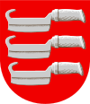
Kärkölä
| coat of arms | map |
|---|---|

|

|
| Basic data | |
| State : |
|
| Landscape : | Päijät-Häme |
| Administrative community : | Lahti |
| Geographical location | 60 ° 37 ′ N , 23 ° 57 ′ E |
| Surface: | 259.34 km² |
| of which land area: | 256.50 km² |
| of which inland waterways: | 2.84 km² |
| Residents : | 4,451 (Dec 31, 2018) |
| Population density : | 17.4 inhabitants / km² |
| Municipality number : | 316 |
| Language (s) : | Finnish |
| Website : | www.karkola.fi |
Kärkölä is a municipality in southern Finland . It is located around 90 kilometers northeast of the capital Helsinki in the Päijät-Häme region .
Kärkölä was part of the Hollola parish until 1867 and became an independent political municipality that year as part of the administrative reform. In addition to the parish village of Kärkölä, the community includes the places Järvelä, Hevonoja, Hongisto, Hähkäniemi, Iso-Sattiala, Karvala, Lappila, Maavehmaa, Marttila, Uusikylä and Vähä-Sattiala. The railway line from Lahti to Riihimäki runs through the municipality ; Passenger trains stop in Järvelä and Lappila .
The largest employers are the municipality itself, the Wienerberger brickworks and the Koskisen Oy plant, which produces wooden house components. Other smaller companies have settled in the industrial areas of Sampola, Kivisoja and Järvelä. Unemployment is around 8 percent.
Sons and daughters
- Olli Pekkala (* 1987), Finnish ski jumper
- Eemeli Väre (1885–1974), Finnish wrestler
Web links
Individual evidence
- ↑ Maanmittauslaitos (Finnish land surveying office): Suomen pinta-alat kunnittain January 1, 2010 (PDF; 199 kB).
- ↑ Statistical Office Finland: Table 11ra - Key figures on population by region, 1990-2018