Kürnach (Pleichach)
| Kürnach | ||
|
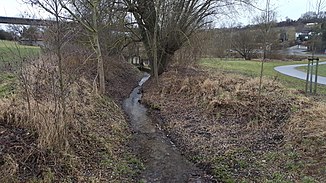
The Kürnach shortly before the semolina mill to Kürnach (2016) |
||
| Data | ||
| Water code | DE : 24364 | |
| location |
Main Franconian plates
|
|
| River system | Rhine | |
| Drain over | Pleichach → Main → Rhine → North Sea | |
| source | in the Rankenholz forest east of the village of Kürnach 49 ° 50 ′ 48 ″ N , 10 ° 4 ′ 7 ″ E |
|
| Source height | approx. 269 m above sea level NHN | |
| muzzle | In Würzburg from the left into the Pleichach coordinates: 49 ° 48 '0 " N , 9 ° 57' 35" E 49 ° 48 '0 " N , 9 ° 57' 35" E |
|
| Mouth height | approx. 186 m above sea level NHN | |
| Height difference | approx. 83 m | |
| Bottom slope | approx. 7.2 ‰ | |
| length | 11.6 km | |
| Catchment area | 32.1 km² | |
The Kürnach is a stream less than 12 km long in the Bavarian district and the city of Würzburg . It is a left tributary of the Pleichach .
Surname
The Kürnach was first mentioned in a document in 779 and was called Quirnaha in Old High German . Quirn means something like mill and aha means water. The brook was mentioned as Mühlbach.
geography
course
The Kürnach rises from the Schwarzen Brunn , which lies east of the village of Kürnach in the northern part of the Rankenholz forest . It flows roughly southwest. It crosses Kürnach and Estenfeld , then changes from the district to the independent city of Würzburg and runs from the Lengfeld district in the closed urban settlement area. At the foot of the B 19 leading northeast to Unterpleichfeld on the plateau , it joins the lowest Pleichach from the left after a total of 11.6 km.
Tributaries
- Höllberggraben, from the left and east in Estenfeld
- Nägeleinsbach, from the left and east to Estenfeld
- Riedbach, from the left and east at the beginning of Lengfeld
Mills
- Obere Mühle, near Kürnach
- Herrenmühle (middle) near Kürnach
- Grießmühle (lower), west of Kürnach
- White Mill (formerly Weismühle or Weissmühle ), south of Estenfeld
- Riedmühle, near Lengfeld
- Wood mill in Lengfeld
- Rosenmühle, in Lengfeld
- Schlinglersmühle
- The three mills of Kürnach
freetime and recreation
The 24-kilometer two-brook bike tour - characterized by two fish on one bike - leads over paved and signposted paths along the Kürnach and Pleichach brooks.
Individual evidence
- ↑ a b BayernAtlas of the Bavarian State Government ( notes )
- ↑ a b Directory of stream and river areas in Bavaria - Main river area, page 83 of the Bavarian State Office for the Environment, as of 2016 (PDF; 3.3 MB)
- ↑ University of Würzburg: Thomas Memminger: Würzburgs streets and buildings. 2nd edition, Gebrüder Memminger Verlagsbuchhandlung, Würzburg 1921, p. 36
- ↑ Unterpleichfeld.de: Bach circuit between Kürnach and Pleichach . Online at www.unterpleichfeld.de. Retrieved March 3, 2016.
Web links
- The Künach on BayernAtlas-Klassik
- Kürnach , WürzburgWiki
- The natural units and their boundaries: 152 Würzburg


