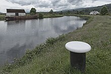
Caledonian Canal

The Caledonian Canal (English Caledonian Canal) runs through the Great Glen and connects the east and west coast of Scotland .
history
Only about a third of the canal was artificially created. Starting in the northeast near Inverness , it runs through the following natural waters: Moray Firth ( North Sea ), River Ness , Loch Dochfour , Loch Ness , Loch Oich , Loch Lochy , Loch Linnhe and Firth of Lorne ( Atlantic Ocean ).
The famous Scottish engineer Thomas Telford was responsible for building the Caledonian Canal . The canal was built from 1803 to 1822 . At the time of the Highland Clearances, the building was also used to create new jobs.
After its completion, the canal did not achieve the economic importance that was first attributed to it. Today it is mainly used for recreation and tourism. It was operated by British Waterways from 1963 to 2012 . Scottish Canals has been responsible ever since .
In 2007 the Caledonian Canal was added to the list of Historic Civil Engineering Landmarks by the American Society of Civil Engineers .
To compensate for the differences in height between the individual holes , 29 locks are required . The total length of the canal is 97 km.
Route
| Beauly Firth | |||
| Clachnaharry Lock | |||
| Far North Line swing bridge (Inverness – Wick railway) | |||
| Clachnaharry (work) lock | |||
| Muirtown Basin | |||
| A862 Muirtown swing bridge | |||
| Muirtown Locks (4) | |||
| A82 Tomnahurich swing bridge | |||
| Dochgarroch lock | |||
| Weir to the Ness | |||
| Loch Dochfour | |||
| Loch Ness | |||
| Oich | |||
| A82 swing bridge | |||
| Fort Augustus locks (5) | |||
| Kytra lock | |||
| Cullochy Lock | |||
| A82 Aberchalder swing bridge | |||
| Weir to the Oich | |||
| Loch Oich | |||
| Laggan Locks (2) | |||
| Loch Lochy | |||
| Lochy | |||
| Upper Gairlochy Lock | |||
| Mucomir hydroelectric power station | |||
| B8004 swivel bridge | |||
| Spean | |||
| Lower Gairlochy Lock (always open) | |||
| Weir | |||
| Loy Aqueduct (Railway and River) | |||
| Muirshearlich Aqueduct | |||
| Sheangain Aqueduct (road and river) | |||
| Mount Alexander Aqueduct | |||
| Lochy | |||
| Banavie lock stairs ( Neptune's Staircase ) (8) | |||
| A830 Banavie swing bridge | |||
| West Highland Line swing bridge (Fort William – Mallaig railway) | |||
| Corpach double lock (2) | |||
| Corpach lock | |||
| Loch Linnhe | |||
Maximum ship dimensions
| Maximum length | 45.72 m |
| Maximum width | 10.67 m |
| Maximum draft | 4.1 m |
| Maximum mast height | 35 m (excluding access to Inverness: 27.4 m) |
literature
- Jean Lindsay: The Canals of Scotland . David & Charles, Newton Abbot 1968.
- Len Paterson: From Sea to Sea: A History of the Scottish Lowland and Highland Canals . Glasgow 2005, ISBN 1-903238-94-3 .
Web links
Individual evidence
- ^ Scottish Canals
- ↑ Skippers Guide to the Caledonian Canal ( Memento of the original from August 5, 2017 in the Internet Archive ) Info: The archive link was automatically inserted and not yet checked. Please check the original and archive link according to the instructions and then remove this notice.
Coordinates: 57 ° 29 ′ 25 ″ N , 4 ° 15 ′ 46 ″ W.

