Kaltbründlberg
| Kaltbründlberg | ||
|---|---|---|
|
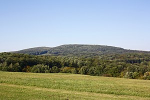
View from the Eichwiese in Kalksburg to the Kaltbründlberg |
||
| height | 508 m above sea level A. | |
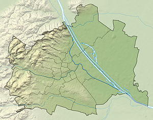
| location | Vienna , Austria | |
| Mountains | Vienna Woods | |
| Dominance | 2.2 km → Dreihufeisenberg | |
| Notch height | 101 m ↓ Wh. Hirschgstemm | |
| Coordinates | 48 ° 10 '8 " N , 16 ° 13' 9" E | |
|
|
||

At 508 m, the Kaltbründlberg is the highest mountain in Vienna's 13th district, Hietzing . The Hubertuswarte is located on the highest crest of its approximately 500 m wide summit .
geography
The Kaltbründlberg is located on the southwestern edge of the Hietzing district in the Auhof cadastral community and is part of the Lainzer Tiergarten . The Mittlere Eichberg rises southeast of the mountain and the Hornauskogel rises 1 km west . The wooded hill is part of the Wienerwald Mountains, the north-eastern foothills of the Eastern Alps . On the southern slopes of the Kaltbründlberg there are parts of the source area of the Gütenbach . This flows into the realms of Liesing .
Origin of name
The Kaltbründlberg was first mentioned in a document in 1925 as Kaltbrünnlberg or Kalter Brünnlberg . It got its name from the Kaltbründlwiese in the south, which has been documented since 1788, originally as Brünndlwiese . The meadow got its name from a cold spring of the Gütenbach stream running along the eastern edge.
literature
- Margarete Platt: The field names in the 10th, 12th and 13th districts of Vienna and in Inzersdorf . Dissertation, Vienna 1997.

