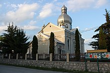
Kamjanky (Pidvolochysk)
| Kamjanky | ||
| Кам'янки | ||

|
|
|
| Basic data | ||
|---|---|---|
| Oblast : | Ternopil Oblast | |
| Rajon : | Pidvolochysk Raion | |
| Height : | 301 m | |
| Area : | Information is missing | |
| Residents : | 1,581 (2001) | |
| Postcodes : | 47840 | |
| Area code : | +380 3543 | |
| Geographic location : | 49 ° 33 ' N , 26 ° 2' E | |
| KOATUU : | 6124682701 | |
| Administrative structure : | 1 village | |
| Address: | вул. Тернопільська 31 47 840 с. Кам'янки |
|
| Website : | Website of the former municipal council | |
| Statistical information | ||
|
|
||
Kamjanky ( Ukrainian Кам'янки ; Russian Каменки Kamenki , Polish Kamionki ) is a village in the east of the Ukrainian Ternopil Oblast with about 1500 inhabitants (2001).
The village, first mentioned in 1564, has belonged to the newly founded settlement community of Pidwolotschysk ( Підволочиська селищна громада Pidwolotschyska selyschtschna hromada ) in the east of Pidwolotschysk since August 9, 2015 .
The village is located at an altitude of 301 m on the bank of the Samez ( Самець ), a 24 km long right tributary of the Sbrutsch , 10 km west of the municipality and district center of Pidvolochysk and 32 km east of the oblast center of Ternopil .
In Kamjanky, the territorial road T – 20–19 meets the trunk road M 12 / E 50 . In the north of the village is the Bohdaniwka-Kamjanka train station ( Богданівка-Кам'янка ) on the Krasne – Odessa railway between Khmelnytskyi and Ternopil.
Web links
- Kamionki . In: Filip Sulimierski, Władysław Walewski (eds.): Słownik geograficzny Królestwa Polskiego i innych krajów słowiańskich . tape 3 : Haag – Kępy . Sulimierskiego and Walewskiego, Warsaw 1882, p. 795 (Polish, edu.pl ).
Individual evidence
- ↑ Local website on the official website of the Verkhovna Rada ; accessed on August 7, 2019 (Ukrainian)
- ↑ history Kamjanky in the history of the towns and villages of the Ukrainian SSR ; accessed on August 7, 2019 (Ukrainian)


