Kaskaskia River
| Kaskaskia River | ||
|
Basin of the Kaskaskia River |
||
| Data | ||
| Water code | US : 426395 | |
| location | Illinois (USA) | |
| River system | Mississippi River | |
| Drain over | Mississippi River → Gulf of Mexico | |
| source | west of Champaign 39 ° 59 ′ 30 ″ N , 88 ° 21 ′ 22 ″ W |
|
| muzzle |
Mississippi River Coordinates: 37 ° 58 ′ 29 " N , 89 ° 56 ′ 14" W 37 ° 58 ′ 29 " N , 89 ° 56 ′ 14" W |
|
| Mouth height |
110 m
|
|
| length | 523 km | |
| Catchment area | 15,041 km² | |
| Discharge at the New Athens A Eo gauge: 13,434 km² |
MQ 2010/2016 Mq 2010/2016 |
155 m³ / s 11.5 l / (s km²) |
| Right tributaries | Shoal Creek, West Okaw River | |
| Reservoirs flowed through | Lake Shelbyville , Lake Carlyle | |
| Small towns | Shelbyville , Vandalia | |
| Communities | Chesterville, New Athens | |
|
Kaskaskia River just before it meets the Mississippi River |
||
|
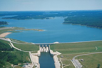
Lake Shelbyville with dam |
||
The Kaskaskia River is a left tributary of the Mississippi River in the US state of Illinois . The 523 km long river drains an area of 51,041 km².
It rises southwest of the city of Champaign and flows south to join the Mississippi River about 10 miles north of Chester .
It is the second longest river in Illinois and drains about 10.2% of the state's land. Until 1881 the river did not flow into the Mississippi until Chester, but in that year the course of the Mississippi changed so that it now flows through the former bed of the Kaskaskia on the route between the current confluence and Chester. The previous course of the Mississippi still forms the state border between Missouri and Illinois, which is why the area around the city of Kaskaskia (which was the capital of Illinois from 1818 to 1820) is west of the Mississippi. Two dams hold back the river to form reservoirs - Lake Shelbyville in Shelby County and Lake Carlyle in Clinton County .
Above Lake Shelbyville is the Kaskaskia River State Fish and Wildlife Management Area . The river was straightened and channeled at the lower reaches. There is a ship lock just before the estuary.
Web links
- Kaskaskia River State Fish & Wildlife Area
- Kaskaskia River Watershed ( Memento June 10, 2008 in the Internet Archive )
- Northern Illinois University: Kaskaskia River in Randolph County ( April 20, 2005 memento in the Internet Archive )
Individual evidence
- ↑ a b Kaskaskia River in the Geographic Names Information System of the United States Geological Survey
- ↑ Watersheds - Kaskaskia . Illinois Rivers Decision Support System (ILRDSS). Retrieved August 14, 2017.
- ↑ USGS 05595000 KASKASKIA RIVER AT NEW ATHENS, IL


