Katherine River
| Katherine River | ||
|
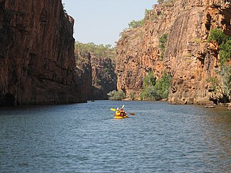
The Katherine River in Katherine |
||
| Data | ||
| location | Northern Territory ( Australia ) | |
| River system | Daly River | |
| Drain over | Daly River → Timor Sea | |
| source | Mount Gilruth (east of Kakadu National Park ) 13 ° 18 ′ 59 ″ S , 133 ° 7 ′ 56 ″ E |
|
| Source height | 451 m | |
| muzzle |
Daly River at Flora River Nature Park Coordinates: 14 ° 39 ′ 23 " S , 131 ° 42 ′ 19" E 14 ° 39 ′ 23 " S , 131 ° 42 ′ 19" E |
|
| Mouth height | 67.6 m | |
| Height difference | 383.4 m | |
| Bottom slope | 1.2 ‰ | |
| length | 328 km | |
| Catchment area | 9569 km² | |
| Left tributaries | Snowdrop Creek, Ironbark Creek, Grace Creek, Emu Creek, Chainman Creek, King River , Limestone Creek | |
| Right tributaries | Gimbat Creek, Turnoff Creek, Snake Creek, Terence Creek, Seventeen Mile Creek, McAddens Creek, Leight Creek, Gum Creek | |
| Flowing lakes | Ngartjuk Billabong | |
| Medium-sized cities | Katherine | |
| Communities | Manbulloo | |
|
Katherine Gorge in Nitmiluk National Park |
||
The Katherine River is a river in the north of the Australian Northern Territory .
geography
River course
The headwaters are east of Kakadu National Park on the southern slopes of Mount Gilruth . From there, the river first flows to the south, turn and then to the west in the Nitmiluk National Park the Gorge Katherine Gorge to flow through. From there it continues its course to the southwest through Katherine and finally forms the Daly River together with the Flora River north of the Flora River Nature Park .
Tributaries with mouth heights
- Snowdrop Creek - 294 m
- Gimbat Creek - 215 m
- Turnoff Creek - 206 m
- Snake Creek - 192 m
- Ironbark Creek - 185 m
- Terence Creek - 183 m
- Grace Creek - 180 m
- Emu Creek - 179 m
- Seventeen Mile Creek - 122 meters
- McAddens Creek - 100 m
- Leight Creek - 100 m
- Chainman Creek - 93 m
- Gum Creek - 84 m
- King River - 76 m
- Limestone Creek - 74 m
Flowing lakes
- Ngartjuk Billabong - 207 m
water falls
history
The first European explorer and namesake was John McDouall Stuart , who named the river in 1862 after the second daughter of the financier of the discovery expedition, John Chambers.
In late January 1998, cyclone Les caused severe thunderstorms that raised the river level to more than 20 meters and flooded a large part of Katherine. Another flood on April 6, 2006 declared a state of emergency as the river again reached a level of almost 19 m at the Katherine Bridge of the Stuart Highway .
Web links
- About the Bridges of Madison County (English)
- Information on the flood in 2006 (English)
Individual evidence
- ^ A b c d e Map of Katherine River, NT . Bonzle.com
- ↑ Section 4: Natural Values of Nitmiluk National Park . Australian Government - Northern Territory ( Memento of the original from March 23, 2015 in the Internet Archive ) Info: The archive link was automatically inserted and has not yet been checked. Please check the original and archive link according to the instructions and then remove this notice.
- ^ Steve Parish: Australian Touring Atlas . Steve Parish Publishing, Archerfield QLD 2007. ISBN 978-1-74193-232-4 . Pp. 95 + 97
- ↑ Bureau of Meteorology: Katherine River Flood 1998 ( Memento of the original from March 17, 2009) Info: The archive link was automatically inserted and not yet checked. Please check the original and archive link according to the instructions and then remove this notice.

