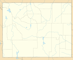
Keyhole State Park
|
Keyhole State Park
|
||
| location | Crook County in Wyoming (USA) | |
| surface | 60 km² | |
| Geographical location | 44 ° 19 ′ N , 104 ° 46 ′ W | |
|
|
||
| administration | Wyoming Division of State Parks and Historic Sites | |
The Keyhole State Park is a 14,720 acres (60 square kilometers) of large State Park in Crook County in the northeast of the US state of Wyoming . It includes the Keyhole Reservoir and its banks. The park is approximately 1250 meters and can be reached via Interstate 90 .
history
The area of the park was given to the Lakota Indians in the Treaty of Fort Laramie in 1868 . After the gold was found in the Black Hills in 1874, the US annexed the area. In 1952, the Bureau of Reclamation built the reservoir by building the Keyhole Dam. The park is named after a ranch brand.
Tourist use
Keyhole State Park is home to wildlife such as mule deer , white-tailed deer, and turkeys . The tourist infrastructure includes a port and nine campsites.
Web links
Individual evidence
- ↑ Brochure: Keyhole State Park. (PDF; 851 kB) (No longer available online.) Wyoming Division of State Parks and Historic Sites, archived from the original on May 26, 2012 ; Retrieved July 18, 2012 . Info: The archive link was inserted automatically and has not yet been checked. Please check the original and archive link according to the instructions and then remove this notice.


