Guernsey State Park
| Lake Guernsey State Park | ||
|---|---|---|
| National Register of Historic Places | ||
| National Historic Landmark District | ||
|
Guernsey State Park Museum |
||
|
|
||
| location | Platte County , Wyoming | |
| Coordinates | 42 ° 18 '58 " N , 104 ° 48' 37.6" W | |
| surface | 15.2 km² (original) 34.8 km² (extension) |
|
| Built | 1925 | |
| NRHP number |
(Original) 97001260 (extension) 80004051 (original) 97001260 (extension) |
|
| Data | ||
| The NRHP added | August 26, 1980 (original) September 25, 1997 (adult) |
|
| As NHLD declared | September 25, 1997 | |
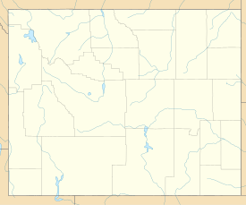
The Guernsey State Park is located 2 kilometers northwest of the city of Guernsey in Platte County of the US state of Wyoming . The North Platte River is dammed in the southeast of the park by the Guernsey Dam and forms the Guernsey Reservoir . The park can be accessed via Interstate 25 and US Highway 26 .
history
Between the 1830s and 1869, the Oregon Trail , which continued west along the North Platte River from Nebraska , was one of the main routes for settlers with covered wagons through Guernsey. On the Oregon Trail Ruts , a National Historic Landmark in the park, the traces of the settlers can still be seen today in an eroded sandstone rib. Just a few kilometers away on the other side of Guernsey is the Register Cliff, another important landmark .
With the help of the Guernsey Dam, completed in 1927, Guernsey Lake was dammed. In the 1930s, the Civilian Conservation Corps (CCC) established the state park's infrastructure, including paths, bridges, shelters, and in 1936 the Guernsey State Park Museum. Since August 1980, the place is listed as a Historic District under the name Guernsey Lake Park in the National Register of Historic Places . In September 1997, the protected area was expanded and recognized as a National Historic Landmark.
Guernsey Dam and Reservoir
The Guernsey Dam was built between 1925 and 1928. Two generators from Guernsey Powerplant have been able to generate up to 6.4 megawatts of electricity since the 1980s , previously 4.8 megawatts were possible. The dam has a height of 41 m and a length of 170 m at the dam crest. The original capacity of 73,810 acre feet was reduced by one third to 46,000 acre feet due to sedimentation. The dammed Guernsey Reservoir has a water surface of 9.5 km² at 1347 meters above sea level. You can go fishing, swimming and boating there. American perch , glass eye perch and catfish live in the reservoir .
See also
Web links
- Official website
- Information and map of the park (pdf; 1010 kB)
- Guernsey Reservoir at US-Parks.com
- National Historic Landmark Nomination (PDF file; 976 kB)
Individual evidence
- ↑ http://www.nps.gov/pwr/customcf/apps/maps/showmap.cfm?alphacode=oreg&parkname=Oregon%20National%20Historic%20Trail
- ↑ http://www.sangres.com/wyoming/stateparks/guernsey.htm
- ↑ Guernsey Lake Park on the National Register of Historic Places , accessed March 14, 2020.
-
↑ Listing of National Historic Landmarks by State: Wyoming. National Park Service , accessed March 14, 2020.
Lake Guernsey State Park on the National Register of Historic Places , accessed March 14, 2020. - ↑ http://www.usbr.gov/projects/Powerplant.jsp?fac_Name=Guernsey%20Powerplant

