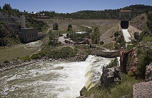
Guernsey Dam
| Guernsey Dam | ||
|---|---|---|
| location | ||
|
|
||
| Coordinates | 42 ° 17 '25 " N , 104 ° 45' 54" W | |
| country |
|
|
| place | Platte County , Wyoming | |
| Waters | North Platte River | |
| Height upstream | 1350 m | |
| power plant | ||
| owner | United States Bureau of Reclamation (USBR) | |
| operator | USBR | |
| construction time | 1925 to 1928 | |
| Start of operation | 1927 | |
| technology | ||
| Bottleneck performance | 6.4 megawatts | |
| Average height of fall |
28 m | |
| Turbines | Francis turbines : 2 × 3.2 MW | |
| Others | ||
The dam Guernsey ( English Guernsey Dam ) is a dam with hydroelectric power plant in Platte County , State of Wyoming , USA . It dams the North Platte River to a reservoir ( English Guernsey Reservoir ). The dam is located approximately 40 km (25 miles ) downstream from Glendo Dam and approximately 15 km northeast of Fort Laramie town . The dam and reservoir are in Guernsey State Park .
The construction of a dam near Guernsey was first considered in 1915. The congress did not approve it until 1924. Construction of the dam began in May 1925. It was completed in July 1927. The construction of the associated hydropower plant was completed in 1928. The dam is owned by the United States Bureau of Reclamation (USBR) and is also operated by the USBR.
Barrier structure
The barrier structure is an earth embankment dam with a height of 41 m (135 ft ) above the foundation level . The dam crest is at an altitude of 1,350 m (4,430 ft) above sea level . The length of the dam crest is 171 m (560 ft). The flood relief is on the left side of the dam. A maximum of 1472 m³ / s (52,000 cft / s) can be discharged via them .
Reservoir
At the normal storage target of 1347 m (4420 ft), the reservoir extends over an area of around 9.7 km² (2400 acres ) and holds 91 million m³ (73,810 acre-feet ) of water. However, the storage space has been reduced considerably over time by sediment deposits.
power plant
The power plant is located at the foot of the dam on the right side of the river. The installed capacity is 6.4 MW . The installed capacity was originally 4.8 MW; from 1992 to 1994 an increase in performance was carried out. The average annual production is around 12 million kWh . The power plant's two Francis turbines each have a maximum output of 3.2 MW. The height of fall is given as 21 or 28 m (70 or 92 ft).
See also
Web links
Individual evidence
- ↑ Guernsey Dam. In: Geographic Names Information System. Retrieved December 28, 2018 (American English).
- ^ A b History of Guernsey Dam. www.wyohistory.org, November 8, 2014, accessed October 1, 2018 .
- ↑ Guernsey Dam Wyoming. National Park Service , accessed October 1, 2018 .
- ↑ a b c d e f Guernsey Dam. United States Bureau of Reclamation (USBR), accessed October 1, 2018 .
- ↑ a b c Guernsey Powerplant. USBR, accessed October 1, 2018 .
- ↑ Guernsey Reservoir. www.recreation.gov, accessed October 1, 2018 .

