Sinks Canyon State Park
|
Sinks Canyon State Park
|
||
|
Canyon walls marked by glaciers |
||
| location | Fremont County in Wyoming (USA) | |
| surface | 243 ha | |
| Geographical location | 42 ° 45 ' N , 108 ° 49' W | |
|
|
||
| Setup date | 1971 | |
| administration | Wyoming Division of State Parks and Historic Sites | |
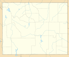
The Sinks Canyon State Park is an elongated State Park in a water-bearing gorge in the Wind River Mountains . It is located 10 km southwest of Lander on Wyoming Highway 131 in Fremont County of the US state Wyoming . The Shoshone National Forest joins in the southwest of the state park .
The Middle Popo Agie River leaves its old creek bed halfway through the gorge and sinks loudly gurgling into a rock opening ("The Sinks"). After a distance of about 400 m as the crow flies, the water comes out again in a spring pot ("The Rise"). For many years it was not clear whether it was actually the same watercourse. Only 1,983 were from the United States Geological Survey and the park employees dyeing tests with rhodamine carried out and found that the water needed over two hours for the underground passage and a larger at the central overflow packing is present, so more water emerges as the sip hole sinks. In this area the river crosses a karst layer of the Madison Limestone Formation . Cracks and crevices have formed in the soluble calcareous rock as a result of erosion processes, in which the water can seep, but which are too narrow to examine their course. Underground chambers, cavities or lakes are not excluded, but are only speculation so far.
On average over the year, the entire water flow sinks underground at an average of 4200 liters per second; the old river bed only serves as an overflow during floods at over 14,000 liters per second. The exact age is unknown, presumably the glaciers of the Ice Age exposed the limestone layer and the water masses of the melting glaciers mechanically and chemically continued the erosion process. The indigenous Indian tribes have known the swallow holes for several generations, the first white trappers appeared at the beginning of the 19th century.
In the gorge three different habitats the shaded northern slopes with dense trees to be distinguished, Douglas and Limb timber, the dry southern slopes with one of juniper and sagebrush dominated shrub society and the wet shore zones with Aspen, pastures and chokeberries and Geranium viscosissimum , Akeleien and Mimulus brevipes . Golden eagles , bighorn sheep and marmots can be seen in the park. In the source pot and downstream, rainbow trout and brown trout have a natural occurrence.
At the Schluckloch there is a visitor center and explanatory boards, at the source pot a viewing platform. There are several hiking trails, picnic spots, and three campsites in the state park.
See also
Individual evidence
- ↑ http://wyoparks.state.wy.us/Site/Brochure/SinksCanyon.pdf ( page no longer available , search in web archives ) Info: The link was automatically marked as defective. Please check the link according to the instructions and then remove this notice. (accessed on September 22, 2010)
- ↑ http://www.wildernet.com/pages/area.cfm?areaID=WYSPSC&CU_ID=1 (accessed on September 22, 2010)


