King William's Town
| King William's Town | ||
|---|---|---|
|
|
||
| Coordinates | 32 ° 52 '42 " S , 27 ° 23' 32" E | |
| Basic data | ||
| Country | South Africa | |
| Eastern Cape | ||
| District | Buffalo City Metropolitan Municipality | |
| ISO 3166-2 | ZA-EC | |
| surface | 65.5 km² | |
| Residents | 34,019 (2011) | |
| density | 519.2 Ew. / km² | |
| founding | 1835 | |
|
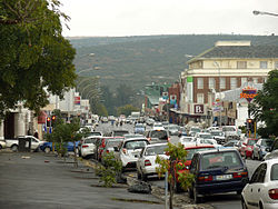
Street in King William's Town
|
||
King William's Town is a city in the metropolitan municipality of Buffalo City , Eastern Cape Province in South Africa . The city is close to the port city of East London and borders the provincial capital Bhisho . Based on the 2011 census, it had 34,019 inhabitants.
history
King William's Town was originally a in 1825 (according to other sources in 1826) by the clergyman John Brownlee of the LMS founded Mission (then Buffalo mission ). In 1835 it was destroyed by the Xhosa tribes during the Sixth Border War (1834-1836) . After the British established a military base, the missionaries returned. The governor of the Cape Colony Benjamin D'Urban founded the city on May 24th that same year. It was named after the English King William IV and was the administrative seat of Queen Adelaide Province. Since December 23, 1847, it was the capital of the Crown Colony of British Kaffraria, which was also proclaimed by Governor Harry Smith . In 1861 it received civil settlement status and was proclaimed a borough .
In 1858 the city was settled by German pensioners of the King's German Legion in the hope of a better life. But many settlers died of starvation. On May 5, 1890, King William's Town was connected to the former railway network.
education
The Amathole Museum shows exhibits on the history of early European settlement, including about German immigrants. The Missionary Museum , a branch of the Amathole Museum, offers an insight into the work of missionaries in southern Africa .
The city is home to the Fort Cox College of Agriculture and Forestry , but its campus is in the southern foothills of the Amathole Mountains near Keiskammahoek .
sons and daughters of the town
- Steve Biko (1946–1977), civil rights activist
- Charles Patrick John Coghlan (1863–1927), first Prime Minister of Southern Rhodesia
- James Percy FitzPatrick (1862–1931), author, politician, entrepreneur
- Andile Yenana (* 1968), South African pianist
- Raven Klaasen (* 1982), tennis player
Web links
- Amathole Museum , Brian Randle: History of King William's Town . on www.museum.za.net (English)
Individual evidence
- ↑ 2011 census , accessed November 22, 2013
- ^ Peter Edmund Raper : Dictionary of Southern African Place Names . Lowry Publishers, Johannesburg 1987 (2nd ed.), Pp. 176-177
- ^ Amathole Museum , Brian Randle: History of King William's Town . on www.museum.za.net (English)
- ^ Basil Holt: Greatheart of the border: A life of John Brownlee, pioneer missionary in South Africa . South African Missionary Museum, King William's Town 1976


