Kingaroy
| Kingaroy | |||||||
|---|---|---|---|---|---|---|---|
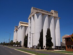
 Kingaroy, peanut silos |
|||||||
|
|||||||
|
|||||||
|
|||||||
|
|||||||
|
|
|||||||
| Kingaroy | ||||||||||||||||||||||||||||||||||||||||||||||||
|---|---|---|---|---|---|---|---|---|---|---|---|---|---|---|---|---|---|---|---|---|---|---|---|---|---|---|---|---|---|---|---|---|---|---|---|---|---|---|---|---|---|---|---|---|---|---|---|---|
| Climate diagram | ||||||||||||||||||||||||||||||||||||||||||||||||
| ||||||||||||||||||||||||||||||||||||||||||||||||
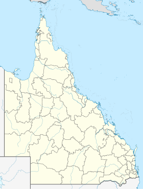
Kingaroy is an agricultural town in rural Queensland , Australia . It is located about 220 kilometers northwest of the capital Brisbane , 150 kilometers north of Toowoomba and 140 kilometers west of Gympie . Kingaroy has approximately 10,100 residents and is the seat of the South Burnett Regional Council .
The area around Kingaroy was first settled in 1843. The first settlement was called Taabinga and was initially just a sheep farm. Today's Kingaroy was not founded until 1904 after a railway line was built from Theebine into the area. The word Kingaroy comes from the Aboriginal language and means red ant.
Kingaroy is located at the junction of the Bunya Highway, which leads from the southwest from Dalby , and the D'Aguilar Highway, which leads from the southeast from Caboolture to Kingaroy.
In Australia, Kingaroy is best known as The Peanut Capital of Australia ( peanut capital of Australia). Kingaroy has the largest peanut processing factory in Australia. Visible from afar and to a certain extent the city's landmarks are three huge silos in which the peanuts are stored. However, since the number and duration of drought and drought increased more and more in the 1990s, peanut production has declined more and more. Many farmers have since switched to growing wine and there are now numerous wineries in the area and a large bottling plant in Kingaroy.
Kingaroy became known as the hometown of the former Prime Minister of Queensland, Sir Joh Bjelke-Petersen, who was in office from 1968 to 1987.
Today there are several festivals in Kingaroy annually, of which the Wine and Food in The Park Festival and the Kingaroy Peanut Festival are among the most famous.
Kingaroy last gained notoriety in October 2007 when, due to the prolonged drought, it was the first place in Australia to be subject to level 7 restrictions on water use. In Queensland, this is the highest level of restrictions that generally prohibit the use of water outside of homes for watering gardens or washing cars.
sons and daughters of the town
- Colin Petersen (* 1946), actor and musician
- Warren Truss (born 1948), politician
- Matthew Hayden (born 1971), international cricket player
- Taliqua Clancy (* 1992), beach volleyball player
Web links
- Website of the South Burnett Regional Council (English)
- Kingaroy Peanut Festival (English)
- Kingaroy Wine & Food Festival in the Park (English)
Individual evidence
- ↑ a b Australian Bureau of Statistics : Kingaroy ( English ) In: 2016 Census QuickStats . June 27, 2017. Retrieved April 14, 2020.
- ↑ Bureau of Meteorology, Australia: Klimeinformationen Kingaroy. World Meteorological Organization, accessed June 7, 2012 .
