Toowoomba
| Toowoomba | |||||||
|---|---|---|---|---|---|---|---|
 Toowoomba satellite image |
|||||||
|
|||||||
|
|||||||
|
|||||||
|
|||||||
|
|
|||||||
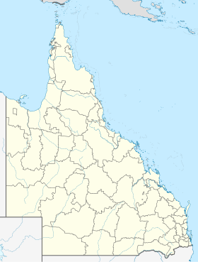
Toowoomba is a city in Australia in the state of Queensland and is also called Garden City . It is 107 km west of Brisbane and has a population of about 100,000. Toowoomba is the second largest inland city in Australia after Canberra . It is the seat of the Local Administrative Area (LGA) Toowoomba Regional Council .
City life
Toowoomba is best known for the University of Southern Queensland (USQ). This was founded in 1967 and has been awarded by the International Council for Open and Distance Education.
More than 23 percent of the population come from Europe. Almost all of the city's residents live in single-family houses. There are many public parks available to residents, such as Queens Park, Laurel Bank Park and Picnic Point Park. From the Picnic Point you have a wonderful view towards Gatton . There are several vineyards, nature reserves and national parks around the city. Toowoomba is therefore suitable as a starting point for tours to the coast as well as to the hill country north of the city or into the lowlands, which begins about 20 km to the west.
There are many hospitals in the city, the most important being St. Vincent's Hospital, St. Andrew's Hospital, and Toowoomba Base Hospital.
Toowoomba is also the cultural center of the Darling Downs farming region . There are several cinemas, a theater and many pubs, with public life being restricted to the daytime. Almost all shops, banks and shopping centers close from around 6 p.m. Even “Clifford Gardens”, the largest shopping center, closes at 6pm.
geography
Toowoomba is on the edge of the Great Dividing Range at an altitude of about 700 meters above sea level. The place is cut by two river valleys that come from the south. These are the East Creek and West Creek, which converge north of the city center and form the Gowrie Creek . The city is thus largely in the catchment area of the Murray-Darling Basin , which flows over the Murray River near Adelaide, which is over 3000 km away, into the Indian Ocean . However, a small part in the east of the urban area drains to Moreton Bay on the Pacific coast.
Usually the biggest problem the city struggles with is the supply of drinking water. Toowoomba was badly affected by the floods in Queensland in 2011 when a sudden meter-high tidal wave from the mountains of the Great Dividing Range in Toowoomba on January 10 undermined a highway, carrying away cars and houses and people in the city. On January 11, it was found that 59 people were missing and nine were killed.
climate
| Toowoomba | ||||||||||||||||||||||||||||||||||||||||||||||||
|---|---|---|---|---|---|---|---|---|---|---|---|---|---|---|---|---|---|---|---|---|---|---|---|---|---|---|---|---|---|---|---|---|---|---|---|---|---|---|---|---|---|---|---|---|---|---|---|---|
| Climate diagram | ||||||||||||||||||||||||||||||||||||||||||||||||
| ||||||||||||||||||||||||||||||||||||||||||||||||
|
Average monthly temperatures and rainfall for Toowoomba
Source: WMO
|
|||||||||||||||||||||||||||||||||||||||||||||||||||||||||||||||||||||||||||||||||||||||||||||||||||||||||
traffic
The main streets are Margaret Street, Ruthven and Russell Street. Ruthven Street is also the inner-city continuation of the New England Highway, which comes from New South Wales via Warwick , Toowoomba and Crows Nest to Bundaberg.
Toowoomba has a small airport and is on the Warrego Highway , an important main road to Brisbane. The city can also be reached by rail on the Brisbane route via Charleville to Cunnamulla or Quilpie . In Toowoomba a route branches off via Armidale towards Dubbo or Sydney .
Personalities
- Christopher Burton (* 1981), eventing rider
- Peter Cameron (* 1947), mathematician
- Tim Cuddihy (* 1987), archer
- Matthew Denny (* 1996), track and field athlete
- Natalie Grinham (* 1978), squash player
- Rachael Grinham (* 1977), squash player
- Sir Littleton Ernest Groom (1867–1936), politician
- Michael Katsidis (* 1980), professional boxer
- Michael Fabian McCarthy (* 1950), bishop
- Will Power (* 1981), racing driver
- Cheryl Praeger (* 1948), mathematician
- Steele Rudd (1868-1935), writer
- Geoffrey Rush (born 1951), actor
- Penelope Wensley (born 1946), Governor of Queensland
Web links
Individual evidence
- ↑ a b Australian Bureau of Statistics : Toowoomba ( English ) In: 2016 Census QuickStats . June 27, 2017. Retrieved April 15, 2020.
- ↑ NZZ-Online on January 10, 2011: Flash flood sweeps through a city in Australia . Retrieved January 10, 2011 .
- ↑ Flash flood death toll rises to 9 . ABC News, January 11, 2011, accessed January 11, 2011 .
