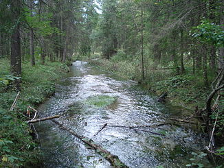
Kohlbach (Ammer, Ettal)
| Kohlbach | ||
|
The Kohlbach near the Große Ammerquellen |
||
| Data | ||
| location | Bavaria , Germany | |
| River system | Danube | |
| Drain over | Ammer → Amper → Isar → Danube → Black Sea | |
| source | on the Kälberalm (1445 m) 47 ° 35 ′ 1 ″ N , 10 ° 58 ′ 46 ″ E |
|
| Source height | approx. 1450 m above sea level NHN | |
| muzzle | north of the Großer Ammerquellen in the municipality of Ettal in the Ammer coordinates: 47 ° 34 ′ 17 ″ N , 11 ° 3 ′ 26 ″ E 47 ° 34 ′ 17 ″ N , 11 ° 3 ′ 26 ″ E |
|
| Mouth height | approx. 850 m above sea level NHN | |
| Height difference | approx. 600 m | |
| Bottom slope | approx. 86 ‰ | |
| length | approx. 7 km | |
The Kohlbach is a left tributary of the Ammer just in the municipality of Ettal and southwest of Oberammergau in the Upper Bavarian district of Garmisch-Partenkirchen .
course
The Kohlbach rises as a Kälberalpgraben on the Kälberalm (1445 m) west of the summit of the Teufelstättkopf . It flows south over a few steps. In the Graswang valley it changes its direction of flow to the east and is called Kohlbach. It runs parallel to the Linder in a wooded area. At Graswang, its stream bed approaches that of the Linder up to 30 meters. In the further course it is reinforced by smaller sources. Bubbles can be seen rising in the water. Some of the water from the springs there comes from the Linder, which seeps further west. North of the Große Ammerquellen , it flows into the Ammer from the left .
fauna
In the forest areas on the Kohlbach, the kingfisher ( Alcedo athis ) and the dipper ( Cinclus cinclus ) can be sporadically observed by the water .
Web links
Individual evidence
- ↑ Google Earth
