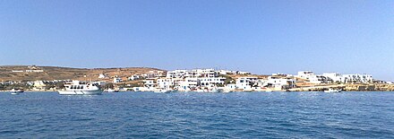
Koufonisia
|
Koufonisia parish Δημοτική Ενότητα Κουφονησίων (Κουφονήσια) |
||
|---|---|---|
|
|
||
| Basic data | ||
| State : |
|
|
| Region : |
South Aegean
|
|
| Regional District : | Naxos | |
| Municipality : | Naxos and Lesser Cyclades | |
| Geographic coordinates : | 36 ° 56 ' N , 25 ° 37' E | |
| Height above d. M .: | 0–434 m Aegean – Papas (on Keros ) |
|
| Area : | 26.025 km² | |
| Residents : | 399 (2011) | |
| Population density : | 15.3 inhabitants / km² | |
| Code No .: | 670205 | |
| Structure: |
1 municipality |
|
| Located in the municipality of Naxos and Lesser Cyclades and in the regional unit of Naxos | ||
Koufonisia ( Greek Κουφονήσια ( n. Pl. )) Is a municipality in the 2011 newly created municipality of Naxos and Little Cyclades . Since 1963 he formed an independent rural community ( kinotita κοινότητα) within the prefecture of the Cyclades .
location
Koufonisia refers to a group of islands in the Small Cyclades and is located between Naxos in the northwest and Amorgos in the southeast. Pano Koufonisi is the only inhabited island in the archipelago and is located about 5 km southeast of Naxos and 20 km northwest of Amorgos. The smaller island of Kato Koufonisi lies to the southwest and is separated from Pano Koufonisi by the 400 m narrow and maximum 8 m deep strait of Koufonisi (Στενό Κουφονησιού). Keros, the largest island in the municipality, is located less than 4 km southeast, Schinoussa 8 km southwest and Donousa 23 km northwest.
The individual islands
natural reserve
The islands are part of the Natura 2000 area GR4220013 Mikres Cyclades: Irakleia, Schinoussa, Koufonisia, Keros, Antikeri kai thal assia zoni (Μικρές Κυκλάδες: από Κέρο μέχρι Ηράκλεια, Σχοινούσσα, Κουφονήσια, Κέρος, Αντικέρι και θαλάσσια ζώνη).
Web links
- Koufonisia , Greek
- Koufonisia , Greek
- Little Cyclades , Greek and English
- Natura 2000 area 4220013 , Greek
Individual evidence
- ↑ Results of the 2011 census, Greek Statistical Office (ΕΛ.ΣΤΑΤ) ( Memento from June 27, 2015 in the Internet Archive ) (Excel document, 2.6 MB)
- ↑ a b c d Charles Arnold (ed.): The islands of the Mediterranean . A unique and complete overview. 2nd Edition. marebuchverlag, Hamburg 2008, ISBN 3-86648-096-2 .


