
South Aegean
 South Aegean Region Περιφέρεια Νότιου Αιγαίου |
|
|---|---|
  |
|
| Basic data | |
| State : | Greece |
| Surface: | 5,286 km² |
| Residents: | 308,975 (2011) |
| Population density: | 57.26 inhabitants per km² |
| Capital: | Ermoupoli |
| Regional districts : | 13 |
| Municipalities : | 34 |
| NUTS 2 code : | EL42 |
| Website : | www.pnai.gov.gr |
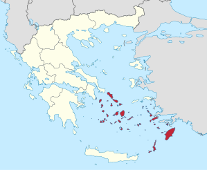
The South Aegean ( Greek Νότιο Αιγαίο Notio Egeo [ ˈnɔtjɔ ɛˈʝɛɔ ]) is one of the 13 regions of Greece that were established in 1987 and have been self-governing since 2011. It extends in the Aegean Sea between the Myrtoischen Sea to the west and the southwest coast of Turkey in the east and consists of a multitude of islands that geographically the archipelago of the Cyclades and the Dodecanese belong, in turn, from the majority of the Southern Sporades and the archipelago around Kastelorizo is . The Cyclades have belonged to the national territory since the independence of modern Greece in 1830, the Dodecanese was the last area to belong to Greece in 1947. Until the implementation of the Kallikratis program in 2011, they each formed their own prefectures. Around a third of the approximately 310,000 inhabitants live on the island of Rhodes . The administrative center is in Ermoupoli ( Ερμούπολη ) on Syros .
Regional districts and municipalities
The South Aegean region is divided into 13 regional districts. In proportion to their population, they send a certain number of MPs to the 51-member regional council.
| Regional district | Residents | Seats | Communities |
|---|---|---|---|
| Andros | 9.221 | 2 | Andros |
| Kalymnos | 29,452 | 5 | Agathonisi , Astypalea , Kalymnos , Leros , Lipsi , Patmos |
| Karpathos and Kasos | 7,310 | 1 | Karpathos , Kasos |
| Kea-Kythnos | 3,911 | 1 | Kea , Kythnos |
| Kos | 34,396 | 5 | Kos , Nisyros |
| Milos | 9,932 | 2 | Kimolos , Milos , Serifos , Sifnos |
| Mykonos | 10.134 | 2 | Mykonos |
| Naxos | 20,837 | 4th | Amorgos , Naxos and Lesser Cyclades |
| Paros | 14,926 | 2 | Andiparos , Paros |
| Rhodes | 119,830 | 20th | Chalki , Megisti , Rhodes , Symi , Tilos |
| Syros | 21,507 | 3 | Syros-Ermoupoli |
| Thira | 18,883 | 3 | Anafi , Folegandros , Ios , Sikinos , Thira |
| Tinos | 8,636 | 1 | Tinos |
Individual evidence
- ↑ a b Results of the 2011 census at the National Statistical Service of Greece (ΕΛ.ΣΤΑΤ) ( Memento from June 27, 2015 in the Internet Archive ) (Excel document, 2.6 MB)
- ↑ Greek Ministry of the Interior: Circular No. 19 on the implementation of the elections of November 7, 2010 for the regional authorities (gr 2010, larisaionpolis.gr ( Memento from September 19, 2011 in the Internet Archive ) (PDF; 557 kB)