Syros
| Syros | ||
|---|---|---|
| Ermoupoli | ||
| Waters | Mediterranean Sea | |
| Archipelago | Cyclades | |
| Geographical location | 37 ° 27 ' N , 24 ° 54' E | |
|
|
||
| length | 16 km | |
| width | 8 kilometers | |
| surface | 84.069 km² | |
| Highest elevation | Pyrgos 442 m |
|
| Residents | 21,505 (2011) 256 inhabitants / km² |
|
| main place | Ermoupoli | |
Syros ( Greek Σύρος ( f. Sg. ), Also Syra or Siros ) is a Greek island of the Cyclades , located almost in the middle of the archipelago , 84.069 km² in size and with the Pyrgos up to 442 m high. In the 8th century BC The island was occupied by Phoenicians, who also gave it the name Syros, which means roughly 'rocky'. The city of Ermoupoli is the capital of the island and the administrative seat of the South Aegean region and the municipality of Syros-Ermoupoli, which also includes the uninhabited island of Gyaros .
geography
With an area of 84,069 km², Syros is the tenth largest Cycladic island. It is located in the north of the archipelago between the North, Central and West Cyclades. Andros , Tinos and Gyaros in the north, Mykonos , Dilos and Rinia in the east, Paros with Andiparos and Serifos in the south, and Kythnos and Kea in the west are all within a radius of 50 km . On the longitudinal axis of Cape Trimiso ( Ακρωτήριο Τρίμεσο ) in the north and Cape Viglostasi ( Ακρωτήριο Βιγλοστάσι ) in the south, the distance is almost 17 km. The island width reaches in the middle at the height between Kini in the west and Ermoupoli in the east about 5 km and further south a maximum of about 10 km from Cape Atsinganokastro ( Ακρωτήριο Ατσιγγανόκαστρο ) in the west to Cape Fokotrypes ( Ακρωτήριο Φωκότρυπς ) on the east coast.
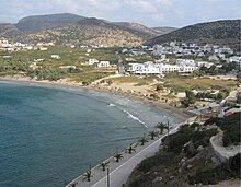
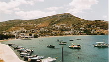
The northern part of the island of Ano Meria ( Άνω Μεριά ) is characterized by a striking mountainous relief with several peaks over 400 m high and reaches the highest point on the island with the Pyrgos ( Πύργος ) 442 m above sea level. A mountain ridge runs through the island on its longitudinal axis to the south. Deep gorges and valleys with dry streams lead from the high areas to the coast. While in the north-east the terrain slopes steeply towards the sea and many coastal areas are difficult to reach by land, the north-west is gentler and divides the coastline into numerous headlands and smaller bays. Along the west coast, the size of the bays increases from north to south and ends in the extreme southwest with the bay of Finikas ( Όρμος Φοίνικα Órmos Fínika ). The change of hill country and smaller coastal plains characterizes the southern part of the island Messaria ( Μεσαριά ). Mainly along the southwest coast there are some higher mountain ridges. The two rocky islands Gaidaros and Strongylo are in front of the deep natural harbor of the Bay of Ermoupoli on the east coast. Further south follows the bay of Azolimnos ( Όρμος Αζολίμνου Órmos Azolímnou ). Smaller harbor bays and capes divide the south coast. The west and southwest coasts are preceded by several small rock islands and rocks, further southeast Aspronisi are about 2 km and Nata 9 km away.
climate
Syros lies in the area of the Mediterranean winter rain climate . A mild spring from March to June is followed by a dry and hot summer from June to October and a mild winter with rainfall from October to March. Much of the annual rainfall of 487.4 mm spread over about 65 rainy days falls in the winter months. Intermittent thunderstorms can be accompanied by heavy torrential rains. Snowfalls and frost days are rare; the long-term average is less than 2 days. The rainiest month is January with 102 mm and about 12 rainy days. In contrast, the three summer months are dry with just 8 mm of precipitation, with the driest month of July having less than 1 mm of precipitation. The average monthly temperature is 18.5 degrees Celsius and fluctuates between 26.6 degrees Celsius in the summer months and 11.4 degrees Celsius in the winter months. The maximum temperature for July is 40.0 degrees Celsius, the lowest temperature - 2.0 degrees Celsius for January.
traffic
Until the end of the 19th century, Ermoupoli had a dominant position among the Greek ports. With the advent of steam shipping and the opening of the Corinth Canal , it lost its importance as a trading port, but is an important hub due to its central location within the Cyclades. Regular intra-Cycladic connections exist from the ferry port in Ermoupoli, as well as with the mainland ports of Piraeus and Lavrio and Kavala in northern Greece . Other destinations are the East Aegean islands of Chios , Ikaria , Fourni and Samos .
Public buses from KTEL Syrou ( ΚΤΕΛ Σύρου ) have been running since 1946 . Several circuits serve the villages in the south of the island, they start and end in Ermoupoli. The island's central bus station has been in the immediate vicinity of the ferry pier since 1990.
Syros airport
The Syros "Dimitrios vikelas" airport ( Κρατικός Αερολιμένας Σύρου "Δημήτριος Βικέλας" (ΚΑΣΟΒ) Kratikós Aeroliménas SYROU "Demetrius Vikelas" , IATA : JSY , ICAO : LGSO ) is located south of Ermoupoli at Manna ( ). The asphalt runway with an orientation of 18/36 is 1,080 m long and 30 m wide. Syros Airport is at an altitude of 72 m (236 ft) above sea level . The airlines Astra Airlines , Olympic Air and Sky Express SA serve the domestic Greek connections with Athens and Thessaloniki.
![]()
economy
The centrally located Cycladic island of Syros is a popular holiday destination with Greeks , not least because of the numerous revitalized buildings from the classical period, but also because of the casino, which is very controversial among the local population.
religion
In the past, the inhabitants of Syros were - unusual for Greece - almost exclusively Catholics of the Latin rite . Due to immigration from around 1820 (uprising against the Turks), this proportion has been reduced to around 40%, so that today's population consists of almost equal parts of Orthodox and Catholics.
history
Individual finds indicate that the island was already settled in the Neolithic Age , while the oldest settlements discovered date from the Bronze Age . Syros gave its name to two consecutive cultures of the Cycladic culture in phase II of the early Cycladic period around 2500 BC. From the Keros-Syros culture a large cemetery with around 600 burials was found near Chalandriani, on the northeast coast of the island is the fortress Kastri, after which the Kastri or Lefkandi culture was named.
Ermoupoli and Ano Syros
The city of Ermoupoli was founded around 1821 as a result of the Greek uprising against Turkish rule and the resulting flight of many Greeks from Chios and other islands. The name is derived from the Greek god Hermes (patron god of merchants and thieves) and means 'city of Hermes'. Today it is the administrative center of the South Aegean region .
Ermoupoli merges seamlessly into Ano Syros, each city on its own hill. Ano Syros forms the older half, mainly inhabited by Catholics, on the left when viewed from the sea, crowned by the Bishop's Cathedral of St. George. Among them are a Capuchin monastery founded in 1633 and a Jesuit monastery .
The city also has one of the oldest archaeological museums in Greece and the Apollon Theater from 1861. The classicist town hall (foundation stone laid in 1876, inauguration in 1898, built by Ernst Ziller ) is located on the marble-paved Platia Miaouli in the city center.
Personalities
- Pherecytes of Syros (* between 584 and 581 BC), Greek pre-Socratics and cosmologist
- Marko Pascha († 1888), personal physician to the Ottoman Sultan
- Demetrius Vikelas (1835–1908), Greek businessman and man of letters
- Emmanouil Roidis (1836–1904), Greek writer
- Markos Vamvakaris (1905–1972), Greek bouzouki player and rebetiko interpreter
literature
- Stephan Spichty: The town hall of Hermoupolis. A travel report . Final thesis of the NDS / gta 1995–1997. ETH Zurich, Institute for the History and Theory of Architecture.
- Sheila Lecoeur: Mussolini's Greek island: Fascism and the Italian occupation of Syros in World War II . London 2009, Tauris Academic Studies, ISBN 978-1-84511-670-5 , p. 260.
Web links
- General information about Syros, Aegean Portal (English)
- Information from the Greek Travel Pages on Syros
Individual evidence
- ↑ Ελληνική Στατιστική Αρχή [ΕΛΣΤΑΤ] (Ed.): Στατιστική Επετηρίδα της Ελλάδος (Statistical Yearbook of Greece) 2009 & 2010. Piraeus 2011, p. 47.
- ↑ KTEL Syrou (Greek)
- ^ Syros Airport. In: airportguide.com. Accessed February 2, 2020 .
- ↑ Syros Domestic Airport "Dimitrios Vikelas"
- ↑ Stephan Spichty: The City Council of Hermoupolis. A travel report . Final thesis of the NDS / gta 1995–1997. ETH Zurich, Institute for the History and Theory of Architecture. P. 68.


