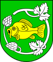
Krasnystaw (rural municipality)
| Gmina Krasnystaw | ||
|---|---|---|

|
|
|
| Basic data | ||
| State : | Poland | |
| Voivodeship : | Lublin | |
| Powiat : | Krasnystaw | |
| Geographic location : | 50 ° 59 ' N , 23 ° 10' E | |
| Height : | 220 m npm | |
| Residents : | see Gmina | |
| Postal code : | 22-300 | |
| Telephone code : | (+48) 82 | |
| License plate : | LKS | |
| Economy and Transport | ||
| Street : | Warsaw - Lviv | |
| Next international airport : | Warsaw | |
| Gmina | ||
| Gminatype: | Rural community | |
| Gmina structure: | 28 localities | |
| 26 school offices | ||
| Surface: | 150.96 km² | |
| Residents: | 8590 (Jun. 30, 2019) |
|
| Population density : | 57 inhabitants / km² | |
| Community number ( GUS ): | 0606052 | |
| administration | ||
| Wójt : | Janusz Korczyński | |
| Address: | ul. M. Konopnickiej 4 22-300 Krasnystaw |
|
| Website : | www.krasnystaw.ug.gov.pl | |
The Gmina wiejska Krasnystaw is a rural municipality in the Powiat Krasnystaw of the Lublin Voivodeship in Poland , the seat of the municipality is the district town of Krasnystaw , which, however, does not belong to the rural municipality. The rural community has an area of 151 km² and 8590 inhabitants (as of June 30, 2019).
Administrative history
From 1975 to 1998 Gmina belonged to the Chełm Voivodeship .
structure
The following 29 school boards belong to the rural municipality of Krasnystaw :
- Białka PSO
- Białka POHZ
- Bzite
- Czarnoziem
- Jaślików
- Józefów
- Kasjan
- Croup
- Krupiec
- Krynica
- Latyczów
- Małochwiej Duży
- Małochwiej Mały
- Niemienice
- Niemienice-Kolonia
- Ostrów Krupski
- Rońsko
- Siennica Nadolna
- Siennica Nadolna (osiedle)
- Stężyca Nadwieprzańska
- Stężyca-Kolonia
- Stężyca Łęczyńska
- Widniówka
- Wincentów
- Zakręcie
- Zastawie-Kolonia
- Zażółkiew
Other places in the rural community are Łany, Namule (gajówka), Namule (leśniczówka) and Tuligłowy.
Web links
Commons : Gmina Krasnystaw - collection of pictures, videos and audio files
- Rural Municipality Website (Polish)
Individual evidence
- ↑ population. Size and Structure by Territorial Division. As of June 30, 2019. Główny Urząd Statystyczny (GUS) (PDF files; 0.99 MiB), accessed December 24, 2019 .
