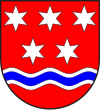
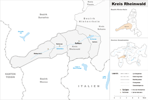
Rheinwald district
| Rheinwald | |
|---|---|

|
|
| Basic data | |
| Canton : | Graubünden (GR) |
| District : | Hinterrhein |
| Main town : | Splügen |
| Surface: | 171.94 km² |
| Residents: | 780 December 31, 2009 |
| Population density : | 5 inhabitants per km² |
| map | |
The county Rheinwald made until 31 December 2015 together with the circles Avers , Domleschg , Shams and Thusis the District Hinterrhein of the Canton of Grisons in Switzerland . The seat of the district office was in Splügen . A merger of all communities in the district to form the Rheinwald community is being examined. The districts were abolished by the Graubünden regional reform.
Communities
The district was made up of the following communities:
| coat of arms | Name of the parish | Population (Dec. 2009) |
Area in km² |
BFS no |
|---|---|---|---|---|
| Hinterrhein | 61 | 48.30 | 3691 | |
| Nufenen | 139 | 28.03 | 3693 | |
| Splügen | 377 | 60.49 | 3694 | |
| Sufers | 144 | 34.62 | 3695 |
Changes in the community since 2000
Mergers
- 2006: Splügen and Medels in the Rheinwald → Splügen
Web links
Commons : Kreis Rheinwald - Collection of images, videos and audio files
- Kurt Wanner: Rheinwald. In: Historical Lexicon of Switzerland .
- Rheinwald district information platform
Individual evidence
- ↑ Initiation of clarifications and preparations for a possible valley merger “Rheinwald” ( memento of the original from March 4, 2016 in the Internet Archive ) Info: The archive link was inserted automatically and has not yet been checked. Please check the original and archive link according to the instructions and then remove this notice. Message on rheinwald.ch of April 4, 2006

