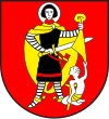
Shams Circle
| Shame | |
|---|---|

|
|
| Basic data | |
| Canton : | Graubünden (GR) |
| District : | Hinterrhein |
| Main town : | Zillis-Reischen |
| Surface: | 201.85 km² |
| Residents: | 1802 December 31, 2009 |
| Population density : | 9 inhabitants per km² |
| map | |
The county Shams made until 31 December 2015 together with the circles Avers , Domleschg , Rheinwald and Thusis the District Hinterrhein of the Canton of Grisons in Switzerland . The seat of the district office was in Zillis-Reischen . The districts were abolished by the Graubünden regional reform.
geography
Geographically, the district of Schams corresponded to the valley community of Schams , the middle section of the Hinterrhein Valley south of the Viamala gorge.
Communities
The district was made up of the following communities:
| coat of arms | Name of the parish | Population (Dec. 2009) |
Area in km² |
BFS no |
|---|---|---|---|---|
| Other | 908 | 46.30 | 3701 | |
| Casti-Wergenstein | 56 | 25.62 | 3703 | |
| Donat | 202 | 4.67 | 3705 | |
| Ferrera | 75 | 75.46 | 3713 | |
| wage | 46 | 8.17 | 3707 | |
| Mathon | 51 | 15.13 | 3708 | |
| Rongellen | 53 | 2.02 | 3711 | |
| Zillis-Reischen | 401 | 24.48 | 3712 |
Changes in the community since 2000
Mergers
Web links
Commons : Kreis Schams - Collection of images, videos and audio files
- Official website of the Schams district
- Jürg Simonett: Shame. In: Historical Lexicon of Switzerland .


