
Sufers
| Sufers | |
|---|---|
 |
|
| State : |
|
| Canton : |
|
| Region : | Viamala |
| BFS no. : | 3695 |
| Postal code : | 7434 |
| Coordinates : | 747 798 / 159 513 |
| Height : | 1430 m above sea level M. |
| Height range : | 1252–3033 m above sea level M. |
| Area : | 34.62 km² |
| Residents: | 144 (December 31, 2018) |
| Population density : | 4 inhabitants per km² |
| Website: | www.sufers.ch |
 Sufers with the A13 |
|
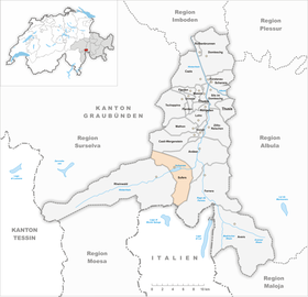
| Location of the municipality | |
  |
|
Sufers ( Rhaeto-Romanic Sur ) is a municipality in the Viamala region . It belongs to the Swiss canton of Graubünden .
coat of arms
Blazon : In red over a silver (white) bordered blue river ribbon a silver Latin cross
The river band as a reference to the Rhine forest is supplemented by the Latin cross , which refers to the Salvator patronage of the church in Sufers.
geography

The scattered village Sufers, lowest settlement in the west-east running Rheinwald , is located north of the Sufnersee jammed Hinterrheins at the mouth of steep Erbach . The municipal ban extends across the valley axis, includes a 4 km long section of the main valley - downstream to the Rofflaschlucht - and includes two side valleys: the 4 km long Steilertal in the north-west and the 7 km long Suretta valley in the south, which on both sides of over 2500 m high mountain ranges and is dominated in the background by the striking glaciated peak of the Surettahorn (3026 m). Around the Steilertal, Teurihorn (2973 m), Alperschällihorn (3039 m, highest point in the municipality) and Grauhörner ( Pizzas d'Anarosa , 3000 m) reach comparable heights.
In 1997, 13% of the community area was used for agriculture. The forest took up 24%, the settlements 1%. The proportion of unproductive area was very high at 62%. This can be explained on the one hand by the altitude, on the other hand by the shape of the side valleys: Both are narrow, extremely steep in the mouth area and the slopes of the upper sections are covered over large areas with scree and unsuitable for alpine farming.
Neighboring communities are Rheinwald , Safien , Casti-Wergenstein , Andeer , Ferrera and Madesimo in the Italian province of Sondrio .
history
The village is mentioned for the first time in 831 as Subere . Ten years later, Emperor Lothar founded a church there. At that time, the outer Rhine Forest, like the neighboring Schams, was populated by Rhaeto-Romans . Since around 1300 the Walser colony of the inner valley ( Nufenen and Hinterrhein ) expanded to Sufers, German has been the main language.
In the three leagues , the place belonged to the gray league as the neighborhood of the Rheinwald court. The economic basis formed the agriculture (cattle breeding and modest arable farming) and since the 15th century the pass traffic over the Splügen and San Bernardino passes . At times, iron ore was mined in the Suretta Valley and smelted in the Schmelzi at the mouth of the valley.
During the Second World War , the Sufers locking point was created north and east of Sufers .
A possible merger with the communities Hinterrhein, Nufenen and Splügen rejected the Sufner voters in 2016. The parish merger took place in 2019 without Sufers.
population
| Population development | ||||||||||||||
|---|---|---|---|---|---|---|---|---|---|---|---|---|---|---|
| year | 1690 | 1807 | 1850 | 1900 | 1950 | 1980 | 1990 | 2000 | 2005 | 2010 | 2012 | 2014 | 2016 | |
| Residents | 186 | 224 | 184 | 104 | 124 | 114 | 111 | 115 | 133 | 129 | 121 | 128 | 126 | |
languages
Despite the Romanesque name of the village, the residents speak German , because the place was settled by Walsers around 1300 . The municipality has therefore been one of the German-speaking localities in the canton of Graubünden for centuries. German is the only official language.
| Languages in Sufers | ||||||
| languages | 1980 census | 1990 census | 2000 census | |||
| number | proportion of | number | proportion of | number | proportion of | |
| German | 105 | 92.11% | 104 | 93.69% | 105 | 91.30% |
| Romansh | 3 | 2.63% | 1 | 0.90% | 4th | 3.48% |
| Residents | 114 | 100% | 111 | 100% | 115 | 100% |
Origin and nationality
Of the 133 residents at the end of 2005, 128 were Swiss nationals.
economy
The overall improvement in connection with the construction of the reservoir at the beginning of the 1960s secured the existence of the remaining Sufner farms. In 2000/2001, 29 people were employed in agriculture and forestry, 28 in the commercial sector and 18 in the service sector. There is a hotel, a dairy and a village shop in the village.
traffic
The community, located on the A13 motorway , is connected to the public transport network by the (Chur–) Thusis – Bellinzona post bus line .
tourism
In summer Sufers is a nice place to relax and hike ( Lai da Vons , Cufercalhütte). In winter the village is the starting point for high mountain tours, and there are ski lifts in the neighboring village of Splügen.
Attractions
- The reformed church in Sufers is a listed building .
- The Sufnersee , an artificial reservoir that is part of the Lago di Lei system , is a popular fishing spot.
- About 2 km down the valley lies the Crestawald fortress, which was built in the Second World War and is now a museum .
literature
- Kurt Wanner: Sufers. In: Historical Lexicon of Switzerland . 2012 .
Web links
- Sufers on the ETHorama platform
- Official website of the municipality of Sufers
Individual evidence
- ↑ Permanent and non-permanent resident population by year, canton, district, municipality, population type and gender (permanent resident population). In: bfs. admin.ch . Federal Statistical Office (FSO), August 31, 2019, accessed on December 22, 2019 .
- ↑ Fusion light in the Rheinwald published on December 5, 2017 on srf.ch, accessed on February 19, 2020
Andeer | Obverse | Casti-Wergenstein | Cazis | Domleschg | Donat | Ferrera | Flerden | Fürstenau | Wages | Masein | Mathon | Rheinwald | Rongellen | Rothenbrunnen | Sharans | Sils im Domleschg | Sufers | Thusis | Tschappina | Urmein | Zillis-Reischen . Former municipalities: Almens | Ausserferrera | Casti | Clugin | Donath | Feldis / Veulden | Hinterrhein | Innerferrera | Medels in the Rheinwald | Mutten | Nufenen | Piping | Patzen-Fardün | Pignia | Portein | Pratval | Prec | Reischen | Sledges | Sarn | Scheid | Splügen | Tartare | Tomils | Trans | Tumegl / Tomils | Wergenstein | Zillis .