
Zillis-Reischen
| Zillis-Reischen | |
|---|---|
 |
|
| State : |
|
| Canton : |
|
| Region : | Viamala |
| BFS no. : | 3712 |
| Postal code : | 7432 |
| Coordinates : | 753 522 / 166 712 |
| Height : | 945 m above sea level M. |
| Height range : | 680–2970 m above sea level M. |
| Area : | 24.47 km² |
| Residents: | 401 (December 31, 2018) |
| Population density : | 16 inhabitants per km² |
| Website: | www.zillis-reischen.ch |
 Zillis-Reischen |
|
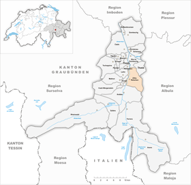
| Location of the municipality | |
  |
|
Zillis-Reischen ( Romansh Ziraun-Reschen ) is a municipality in the Viamala region in the canton of Graubünden in Switzerland .
geography
The two villages Zillis ( Italian Zirano , Rhaeto-Romanic Ziràn ) and Reischen ( 1024 m above sea level ) lie on the western slope of the Curvér Pintg da Taspegn ( 2731 m ). They lie east of the Hinterrhein and belong to the shame . The Ual da Reschen flows north of Reischen and flows into the Hinterrhein. Reischen lies on the slope, the village of Zillis (Graubünden Romanesque Ziran ; 945 m ) in the valley floor. The valley floor on the left side of the Rhine also belongs to the municipality. The Traversiner Tobel forms the northern border, the mountain range around Piz Curvér ( 2972 m ) the eastern border of the municipality. In addition to the two villages, Spegnet ( 1467 m ) and Nasch ( 1670 m ) as well as several individual farms belong to the municipality.
Of the entire municipal area of almost 25 km², 1,048 hectares are forested and 559 hectares of mountains. In addition to 45 hectares of settlement area, there is 794 hectares of arable land, 654 hectares of which are cultivated as alpine pastures.
Zillis is the destination of the Veia Traversina .
history
Zillis has an old settlement. This is proven by finds from Roman times and a church complex from 500 AD. The place is also the capital of the entire region of Schams. After 1530 the Reformation was introduced. The municipality of Zillis-Reischen has existed since 1865, when the municipality of Reischen merged with Zillis.
The Zillis cult cave on the southern edge of the village of Zillis served as a cult cave from the 2nd to the 6th century.
During the Second World War , the Reischen / Via Mala barrier was set up in Reischen to block access to the Viamala narrow.
population
| Population development | |||||||||||
|---|---|---|---|---|---|---|---|---|---|---|---|
| year | 1870 | 1900 | 1950 | 1980 | 1990 | 2000 | 2005 | 2010 | 2012 | 2014 | 2016 |
| Residents | 396 | 263 | 276 | 252 | 312 | 330 | 368 | 448 | 424 | 410 | 391 |
languages
Originally, the residents spoke Sutselvisch , a Graubünden Romance dialect. Until around 1850 the community was monolingual, but the proportion of Romansh speakers decreased to 78% by 1910. In 1940 the novels were only a narrow majority of 56%. After that, the language change towards German accelerated more and more. Today, German is the only official language, although 30% of the population still understand Romansh.
| Languages in Zillis | ||||||
| languages | 1980 census | 1990 census | 2000 census | |||
| number | proportion of | number | proportion of | number | proportion of | |
| German | 136 | 53.97% | 229 | 73.40% | 263 | 79.70% |
| Romansh | 104 | 41.27% | 72 | 23.08% | 42 | 12.73% |
| Residents | 252 | 100% | 312 | 100% | 330 | 100% |
Origin and nationality
Of the 368 residents at the end of 2005, 341 were Swiss nationals.
power supply
There is a thermal spring in the municipality, with the help of heat pumps the 13 ° C warm mineral water , which can be used for healing purposes , is used to heat 90 buildings in the municipality via a local heating network .
politics
coat of arms
Blazon : “In silver, a golden nimbly , standing, looking, black-haired, gold- clad and spurred, silver saint with red undergarments and trousers as well as a black scabbard, the blue cloak with a black-stapled silver sword for the beggar kneeling in gold in natural colors dividing, accompanied by two six-pointed red stars in the upper corners. "
Declaration of coat of arms: Saint Martin refers to the important valley church in Zillis, while the two stars symbolize the two parts of the community.
Attractions
- The most famous building is the church of St. Martin Zillis (12th century) with the oldest painted field ceiling in Europe.
- House in Reischen.
- Above Reischen are the ruins of La Tur Castle and Haselstein Castle, which was privately rebuilt.
- The Viamala Gorge is three kilometers from Zillis .
photos

Zillis in the first half of the 19th century

Zillis - coat of arms of the three leagues from 1608
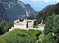
Haselstein Castle


literature
- The municipalities of the canton of Graubünden. Chur / Zurich, 2003. ISBN 3-7253-0741-5
- Jürg Simonett: Reischen. In: Historical Lexicon of Switzerland . 2011 .
- editor: Zillis-Reischen. In: Historical Lexicon of Switzerland . 2012 .
- Jürg Simonett: Zillis. In: Historical Lexicon of Switzerland . 2014 .
Web links
- Zillis-Reischen on the ETHorama platform
- Official website of the municipality of Zillis-Reischen
Individual evidence
- ↑ Permanent and non-permanent resident population by year, canton, district, municipality, population type and gender (permanent resident population). In: bfs. admin.ch . Federal Statistical Office (FSO), August 31, 2019, accessed on December 22, 2019 .
- ↑ Zillis-Reischen - Portrait. Retrieved April 28, 2018 .
- ↑ House in Reischen on graubuendenkultur.ch
- ↑ Haselstein Castle on Pro Castellis .ch
Andeer | Obverse | Casti-Wergenstein | Cazis | Domleschg | Donat | Ferrera | Flerden | Fürstenau | Wages | Masein | Mathon | Rheinwald | Rongellen | Rothenbrunnen | Sharans | Sils im Domleschg | Sufers | Thusis | Tschappina | Urmein | Zillis-Reischen . Former municipalities: Almens | Ausserferrera | Casti | Clugin | Donath | Feldis / Veulden | Hinterrhein | Innerferrera | Medels in the Rheinwald | Mutten | Nufenen | Piping | Patzen-Fardün | Pignia | Portein | Pratval | Prec | Reischen | Sledges | Sarn | Scheid | Splügen | Tartare | Tomils | Trans | Tumegl / Tomils | Wergenstein | Zillis .