Krieau
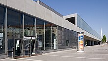
The Krieau is part of the 2nd Viennese district Leopoldstadt . The Krieau is also part of the Prater and borders on the new Vienna exhibition center, which was completed in 2004 .
history
The name is derived from Kriegsau : From the middle of the 16th century there was a dispute between Klosterneuburg Abbey and the City of Vienna for almost seven decades , until the Krieau was awarded to Vienna in 1618.
The Krieau was a floodplain that was flooded again and again and formed an almost uninhabited island on the unregulated Danube , on which driven hunts took place. On a Prater map from 1825, the Grünaue (sic!) Is bordered in the north, west and south by the Heustadelwasser, an arm of the Danube, and in the east by the main stream. At that time, the haystack water, branching off from other branches of the river near today's Messe Wien, flowed over the site of today's Krieau trotting track to the main avenue of the Prater, then took today's course and flowed into wider Danube arms near today's Stadlauer Ostbahnbrücke and the Lusthaus. On the island there was a hunter's house, a hay barn and mills as well as alluvial forest and meadows.
In 1866/1867 two bridges were built over the Heustadelwasser along the main avenue to complete the straight connection from the Praterstern to the Lusthaus. As a result of the Viennese Danube regulation completed in 1875 , the haystack water became stagnant water, its sections closer to the new main stream were filled in and used as building ground. The Krieau was now part of the large Leopoldstadt Danube Island. The right bank of the new Danube river, the Handelskai , was intended for factories, warehouses and shipping areas.
The grounds of the 1873 World Exhibition , the most famous building of which was the rotunda , also extended into the Krieau . The last remnants are the pavilions of art, today the federal sculptor's studios , two opposite buildings on Meiereistraße, one of which was rebuilt after war damage. In 1878 the Krieau trotting track was opened.
On a map of Leopoldstadt around 1925, Krieau u. a. the Krieau dairy (to which you can get from Hauptallee via the still existing Meiereistraße; for example at the Stadion subway station), the Hakoah sports field not far from its current location, a "day-care center for the Free School - Kinderfreunde association " for example at the location of today's stadium pool (which, like the stadium, had not yet been built), a large "playground of the Vienna Golf Club" (labeled as "Campagnereiter-Gesellschaft" on the 2008 city map and from the A23 Südosttangente , a city motorway) Stilts, cut through) and a "sports field of the Viennese professional fire brigade" (today allotment area).
Instead of the stadium pool there was a wooded area called "Rondeaumais" around 1925, and instead of the stadium there was the "Bienenhüttenwiese". At the Handelskai in the Krieau area, there were a margarine, a fan and two leather factories, the "Mälzerei der Hütteldorfer Bierbrauerei AG" and the "Margarin Stearin Candle Factory Salvator of the Viennese Fleischhauer Comp.".
In 1928 the construction of the Prater Stadium began in the Krieau. The former Au lost its original character more and more and was largely transformed into a green landscape with large sports facilities.
The Krieau today
In the 1970s, with the construction of the motorway, the area finally lost its previously somewhat secluded location. In the years 2003–2008 the underground line U2 was extended from the city center to the stadium; it runs in the Krieau as an elevated railway and has two stations here, Krieau and Stadion . A shopping center was built at the Stadion station.
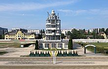
In the years 2007–2010, a new office and residential district with an area of approx. 40,000 m² was built in the Krieau with Viertel Zwei . In the coming years, the second quarter is to be expanded, with more office space and living space for 1,800 people being created largely on the area of the trotting track. The 36,700 m² area along Trabrennstrasse was completed in 2017/18.
Web links
Individual evidence
- ^ Felix Czeike : Historical Lexicon Vienna. Volume 3: Ha-La. Kremayr & Scheriau, Vienna 1994, ISBN 3-218-00545-0 , p. 614.
- ^ KE Rainold: Memories of strange objects and events , Vienna 1825, p. 193
- ↑ Plan of the II. Viennese district Leopoldstadt , scale 1: 15,000, execution and printing: Kartographisches, formerly Military Geographic Institute in Vienna, undated
- ↑ Extension of Viertel Zwei on wien.orf.at, accessed on February 15, 2015
Coordinates: 48 ° 12 ′ 39 ″ N , 16 ° 24 ′ 51 ″ E


