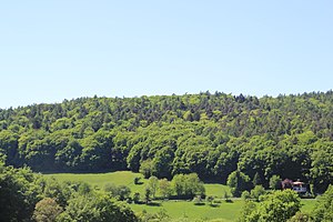
Kriegelberg
| Kriegelberg | ||
|---|---|---|
|
Kriegel mountain of Kleinhemsbach seen from |
||
| height | 395 m above sea level NHN | |
| location | District of Aschaffenburg , Bavaria (Germany) | |
| Mountains | Spessart | |
| Dominance | 0.21 km → Hahnenkamm main summit | |
| Notch height | 9 m | |
| Coordinates | 50 ° 4 '29 " N , 9 ° 6' 43" E | |
|
|
||
The Kriegelberg is a 395 meter high mountain in the Spessart in the Bavarian district of Aschaffenburg . It belongs to the Hahnenkamm ridge .
geography
Kriegel mountain is on the district of Hörstein above Hemsbach , southeast of the cockscomb main peak. Because of its low dominance (210 m) and notch height (9 m), it can be regarded as its secondary peak. The municipal boundary between Alzenau and Mömbris runs about 170 m below the Kriegelberg on the outskirts of Hemsbach. Its western slopes drop steeply to the Vockenbach , to the east it is bordered by the valley of the Hemsbach . In the south, the Kriegelberg goes flat towards the stamp height . In the notch between cockscomb and Kriegel Berg extending Frankish Marienweg .

