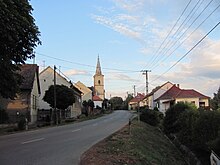
Lápafő
| Lápafő | ||||
|
||||
| Basic data | ||||
|---|---|---|---|---|
| State : | Hungary | |||
| Region : | Southern Transdanubia | |||
| County : | Tolna | |||
| Small area until December 31, 2012 : | Dombóvár | |||
| District since 1.1.2013 : | Dombóvár | |||
| Coordinates : | 46 ° 31 ' N , 18 ° 3' E | |||
| Area : | 9.31 km² | |||
| Residents : | 152 (Jan 1, 2011) | |||
| Population density : | 16 inhabitants per km² | |||
| Telephone code : | (+36) 74 | |||
| Postal code : | 7214 | |||
| KSH kódja: | 14605 | |||
| Structure and administration (as of 2020) | ||||
| Community type : | local community | |||
| Mayor : | Károly László Kirtyán (independent) | |||
| Postal address : | Kossuth Lajos u. 1 7214 Lápafő |
|||
| Website : | ||||
| (Source: A Magyar Köztársaság helységnévkönyve 2011. január 1st at Központi statisztikai hivatal ) | ||||
Lápafő is a Hungarian community in the county Dombóvár in Tolna county .
Geographical location
Lápafő is located about 16 kilometers northwest of the city of Dombóvár , on the small river Lápafő of the same name. Neighboring communities are Várong , Nak and Szaks .
history
A few years ago the remains of a medieval church were uncovered in the municipality. At that time the place was called Vápafő .
Attractions
- Reformed Church, built in 1785
- Jóska Sobri Park ( Sobri Jóska emlékhely )
Sons and daughters of the church
- Károly Galgóczy (1823–1916), agricultural economist
traffic
Roads No. 6507 and No. 6517 meet in Lápafő. The nearest train station is in Dombóvár .
literature
- András K. Németh, Melinda Takács: A középkori Lápafő és temploma (PDF file; 1.48 MB). In: A Kaposvári Rippl-Rónai Múzeum Közleményei , Volume 2, pp. 61–81. 2013. ISSN 2064-1966
Web links
- Official website ( Hungarian )
- Lápafő (Hungarian)


