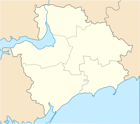
Lahidne (Tokmak)
| Lahidne | ||
| Лагідне | ||

|
|
|
| Basic data | ||
|---|---|---|
| Oblast : | Zaporizhia Oblast | |
| Rajon : | Tokmak district | |
| Height : | 39 m | |
| Area : | 0.674 km² | |
| Residents : | 883 (2001) | |
| Population density : | 1,310 inhabitants per km² | |
| Postcodes : | 71774 | |
| Area code : | +380 6178 | |
| Geographic location : | 47 ° 3 ' N , 35 ° 42' E | |
| KOATUU : | 2325281601 | |
| Administrative structure : | 6 villages, 1 settlement | |
| Address: | вул. Центральна 110 71774 с. Лагідне |
|
| Statistical information | ||
|
|
||
Lahidne ( Ukrainian Лагідне ; Russian Лагидное Lagidnoje ) is a village in the center of the Ukrainian Oblast of Zaporizhia with about 880 inhabitants (2001).
The 1842 by German Mennonites ( Molotschna ) as Reimera (Реймера) founded village was called 1932-2016 Kirowe ( Кірове ) and received in the course of de-communization in Ukraine its present name. Lahidne is located on the banks of the Yushanly ( Юшанли ), a 94 km long, left tributary of the Molochna in the south of Tokmak Rajon 30 km south of the district center Tokmak and 125 km southeast of the Oblast center Zaporizhia .
The 61.46 km² district council with a total of around 2300 inhabitants, whose administrative center is Lahidne, also includes the villages of Hruschiwka ( Грушівка ⊙ ) with around 390 inhabitants, Mohutnje ( Могутнє ⊙ ) with around 160 inhabitants, Roskishne ( Розківішне ⊙ ) 260 inhabitants, Udarnyk ( Ударник ⊙ ) with about 460 inhabitants and the settlement Sorjane ( Ударник ⊙ ) with about 160 inhabitants.
Individual evidence
- ↑ Website of the village , accessed on June 20, 2017 (Ukrainian)

