Lake Karapiro
| Lake Karapiro | |||||||
|---|---|---|---|---|---|---|---|
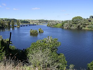
| Lake Karapiro with the Maungatautari Road bridge | |||||||
|
|||||||
|
|
|||||||
| Coordinates | 37 ° 56 '34 " S , 175 ° 33' 36" O | ||||||
| Data on the structure | |||||||
| Lock type: | Arch dam | ||||||
| Construction time: | 1940-1947 | ||||||
| Height of the barrier structure : | 52.4 m | ||||||
| Crown length: | 335 m | ||||||
| Crown width: | 2.4 m | ||||||
| Base width: | 15.2 m | ||||||
| Power plant output: | 90 MW | ||||||
| Operator: | Mercury NZ Limited | ||||||
| Data on the reservoir | |||||||
| Altitude (at congestion destination ) | 50.62 m - 53.45 m | ||||||
| Water surface | 7.7 km² | ||||||
| Reservoir length | 20 km | ||||||
| Reservoir width | 80 - 620 m | ||||||
| Maximum depth | 34 m | ||||||
| Catchment area | 839 km² | ||||||
The Lake Karapiro is the river system of the Waikato River belonging Reservoir on the North Island of New Zealand .
Origin of name
In the Māori language, the name " Karapiro " is composed of the words " kara " for "stone" and " piro " for "foul smelling" . According to legend, Karapiro was under the influence of chief O-Te-Ihingarangi and was the place where the Ngati Haua tribe and their allies from the Tauranga area made a defense pact during the land wars of 1864.
geography
The 7.7 km 2 large Lake Karapiro is located 5 km southeast of the city of Cambridge and around 8 km west of the city of Tirau . The lake, which extends in the valley of the former river bed of the Waikato River , has a length of around 20 km and its width varies between 80 and a maximum of 620 m. The height of the lake varies depending on the water level between 50.62 m and 53.45 m, with a maximum lake depth of 34 m. Its immediate water catchment area is 839 km 2 .
The reservoir can be reached from New Zealand State Highway 1 , which flanks the lake on its lower half on its north side.
Administratively, the lake belongs to the Waikato region .
The Lake Karapiro go reservoirs Lake Arapuni , Lake Waipapa , Lake Maraetai , Lake Whakamaru , Lake Atiamuri , Lake Ohakuri and Lake Aratiatia advance.
history
The reservoir and the associated hydropower plant were put into operation in 1947 and were designed for a nominal output of 90 MW . As of 2020, the operator of the hydropower plant is the majority state-owned company Mercury NZ Limited .
Panoramic photo
See also
literature
- CHD Magadza : Physical and chemical limnology of six hydroelectric lakes on the Waikato River, 1970-72 . In: New Zealand Journal of Marine and Freshwater Research . Vol. 13, Issue 4 , 1979, pp. 561-572 , doi : 10.1080 / 00288330.1979.9515835 (English).
- Tracey Edwards, Mary de Winton, John Clayton : Assessment of the ecological condition of lakes in the Waikato region using LakeSPI - 2010 . In: Environment Waikato (Ed.): Environment Waikato Technical Report . 2010/24 , June 2010, ISSN 1177-9284 (English).
Individual evidence
- ↑ a b c d Topo maps . Land Information New Zealand , accessed January 5, 2020 .
- ↑ 09. Karapiro - Overview . Mighty River Power , archived from the original on July 20, 2011 ; accessed on January 10, 2020 (English, original website no longer available).
- ^ A b Edwards, Winton, Clayton : Assessment of the ecological condition of lakes in the Waikato region using LakeSPI - 2010 . 2010, p. 3 .
- ↑ Coordinates and longitudes were determined using Goggle Earth Pro Version 7.3.2.5776 on January 5th, 2020
- ^ Waikato Lake Levels . Mercury NZ Limited , accessed January 5, 2020 .
- ↑ Magadza : Physical and chemical limnology of six hydroelectric lakes on the Waikato River, 1970-72 . 1979, p. 572 .
- ↑ Hydro Generation . Mercury NZ Limited , accessed January 5, 2020 .
- ↑ 09. Karapiro . Mighty River Power , archived from the original on July 20, 2011 ; accessed on January 5, 2020 (English, original website no longer available).


