Lake Pukaki
| Lake Pukaki | |
|---|---|

|
|
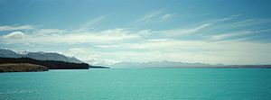
| Lake Pukaki, 2013 | |
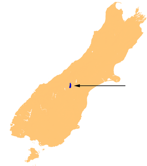
| Geographical location | South Island New Zealand |
| Tributaries | Tasman River |
| Drain | Pukaki River |
| Data | |
| Coordinates | 44 ° 7 ′ 0 ″ S , 170 ° 10 ′ 0 ″ E |
| Altitude above sea level | 518.2-532 m |
| surface | 82 km² (winter) 87 km² (summer) |
| volume | 4.66 km³ |
| Maximum depth | 70 m |
| Middle deep | 47 m |
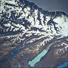
The Lake Pukaki is a lake on the South Island of New Zealand . It is the largest of three lakes running almost parallel in a north-south direction on the northern edge of the Mackenzie Basin . The other two are Lake Ohau and Lake Tekapo .
General

All three lakes were created by retreating glaciers , the valley of which was blocked by the deposition of their terminal moraine . The inflow of glacier water gives the lakes a typical blue color, which is created by fine particles from the abrasion of the glacier underground.
The catchment area of the lake is 1413 km². The surface of the lake is between 82 km² and 87 km², depending on the season, and the height of the lake level above the sea varies between 518.2 m and 532 m.
The lake is fed at its northern end by the Tasman River , an intertwined river that has its source in the Tasman Glacier and Hooker Glacier , near Aoraki / Mount Cook . From the south side of the lake you have a good view of the mountains 70 km to the north.
The outflow of the lake, the Pukaki River , is at the southern end of the lake. The lake is the upper part of the hydropower project on the Waitaki River . There are several dams and canals near the drain that connect it to Lake Tekapo and Lake Ruataniwha .
In the 1940s the water level of the lake was raised by 9 m by a dam. In the 1970s, the dam was expanded and the water level of the lake was raised by another 37 m. The island of Five Pound Note Island , which was previously depicted on New Zealand's five pound banknote, was flooded.
Power plant Ohau A
In the 1970s, the Ohau A power plant was built, which is supplied with water from Lake Pukaki via a canal. Currently, the possible operational fluctuations in the water level are 13.8 m, which corresponds to a stored energy of 1600 GWh. Together with Lake Tekapo's 770 GWh, this is more than half of the stored hydropower in New Zealand.
Web links
literature
- J. Irwin : Bottom sediments of Lake Tekapo compared with adjacent Lakes Pukaki and Ohau, South Island, New Zealand . In: NZ Journal of Marine and Freshwater Research . Vol. 3 , No. September 12 , 1978, p. 245–250 , doi : 10.1080 / 00288330.1978.9515749 (English).
Individual evidence
- ↑ Irwin : Bottom sediments of Lake Tekapo Compared with Adjacent Lakes Pukaki and Ohau ... . 1978, p. 245 .
- ^ Lake levels . Meridian Energy , accessed April 25, 2019 .
- ↑ Discover Waitaki. (PDF; 986 kB) (No longer available online.) Meridian Energy, archived from the original on March 4, 2016 ; accessed on June 14, 2015 (English, original website no longer available).
