Lake Traverse
| Lake Traverse | |||||||||
|---|---|---|---|---|---|---|---|---|---|
| Southern end of Lake Traverse at the bottom of the picture | |||||||||
|
|||||||||
|
|
|||||||||
| Coordinates | 45 ° 41 ′ 18 ″ N , 96 ° 44 ′ 15 ″ W | ||||||||
| Data on the structure | |||||||||
| Construction time: | 1936-1941 | ||||||||
| Data on the reservoir | |||||||||
| Altitude (at congestion destination ) | 297 m | ||||||||
| Water surface | 43.9 km² | ||||||||
| Reservoir length | 26 km | ||||||||
| Reservoir width | 2.5 km | ||||||||
| Maximum depth | 4 m | ||||||||
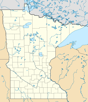
The Lake Traverse is the southernmost waters in the catchment area of the Hudson Bay . The border between the US states of Minnesota and South Dakota runs along the 26 km long elongated lake. A low continental divide separates the land on the south shore of Lake Traverse from the Little Minnesota River , which is part of the Mississippi River system and flows through the village of Browns Valley less than two kilometers from the lake .
During the last glacial the southern end of Lake Traverse the southern drain was of glacial Agassiz by the so-called traverse Gap in the lakebed River Warren ; who formed the valley through which the Minnesota River now flows.
Lake Traverse is fed, among other things, by the Mustinka River , which flows near the dam at the northern end of the lake , which was built by the United States Army Corps of Engineers in 1936–1941 to regulate the flow rate and thus the level of the lake. The only outflow is at the northern end of the Bois de Sioux River , a tributary of the Red River of the North .

