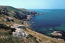
Land's End
Land's End ( Cornish Penn an Wlas [KK], Pen an Wlas [UCR] ), located near Penzance , Cornwall , is a town and the headland of the same name . The tip of the headland is England's westernmost point on the main island of Great Britain . It separates the English Channel to the east from the Celtic Sea in the west. About 40 kilometers south-east is located on the Peninsula The Lizard of Lizard Point , the most southerly point in Britain. The Isles of Scilly, about 45 kilometers southwest of Land's End, are the most westerly point of England. When the weather is clear, they can be seen from the approximately 60-meter-high cliff above the Atlantic . Furthermore, the Longship lighthouse (1795, or successor building from 1893), located about two kilometers to the south, is visible from here, which stands on an island made of quartzite and serpentinite .
Due to its geographical location, Land's End is often the starting point for hikes (on the South West Coast Path ), bike tours, trips and rallies across Great Britain, for example with vintage cars . The counterparts are John o 'Groats , the (supposedly) northernmost point on the main island of Great Britain, and Lowestoft , the most easterly point on the main island of Great Britain. Great distances are often described in Great Britain using the metaphor "from Land's End to John o 'Groats".
Nearby is Pendeen Lighthouse and north of it is Cape Cornwall . The Bristol Channel and the Irish Sea to the north and the English Channel to the south begin at this cape . That headland used to be the most westerly point of England until accurate measurements showed that Land's End is the most westerly point.
Legend has it that the sunken land of Lyonesse was located between Land's End and the Isles of Scilly.
Land's End is now privately owned. There is a tourist-oriented theme park with a hotel, shops and, among other things, some ships such as the fishing cutter Confide ( PZ-741 ) and the RNLI sea rescue cruiser RNLB James & Catherine Macfarlane , which can be visited. Land's End Airport is in the immediate vicinity .
In front of and in the cliffs there is a ship cemetery due to the exposed location. The wreck of the freighter RMS Mülheim with its home port Duisburg, which ran aground in 2003, is a few hundred meters north of the tip, many other sunken ships lie in the immediate vicinity untouched under the water surface and attract divers, such as the Black Swan Project .
literature
- Emil Huebner : Antivestaeum . In: Paulys Realencyclopadie der classischen Antiquity Science (RE). Volume I, 2, Stuttgart 1894, Col. 2561.
Web links
Individual evidence
- ↑ Description of the rally at heroevents.eu ( Memento from September 2, 2015 in the Internet Archive ) (English)
Coordinates: 50 ° 4 ′ 7.6 ″ N , 5 ° 43 ′ 1.3 ″ W.


