Langentalgraben (Dreisgraben)
| Vallunga ditch | ||
|
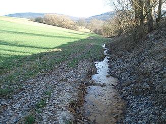
The Langentalgraben below the new landfill |
||
| Data | ||
| location |
Spessart
|
|
| River system | Rhine | |
| Drain over | Dreisgraben → Aubach → Elsava → Main → Rhine → North Sea | |
| source | northwest of Schmachtenberg 49 ° 47 ′ 29 ″ N , 9 ° 13 ′ 17 ″ E |
|
| Source height | 295 m above sea level NHN | |
| muzzle | west of Mönchberg in the Dreisgraben Coordinates: 49 ° 47 '50 " N , 9 ° 15' 2" E 49 ° 47 '50 " N , 9 ° 15' 2" E |
|
| Mouth height | 195 m above sea level NHN | |
| Height difference | 100 m | |
| Bottom slope | 40 ‰ | |
| length | 2.5 km | |
| Catchment area | 2.3 km² | |
The Langentalgraben is a left, periodic tributary of the Dreisgraben in the Miltenberg district in the Bavarian Spessart .
geography
course
The Langentalgraben rises northwest of Schmachtenberg . It flows into the Dreisgraben west of Mönchberg .
Elsava river system
See also
Web links
Commons : Langentalgraben - Collection of images, videos and audio files
Individual evidence

The Langentalgraben (front left) flows into the Dreisgraben (from front right to back)
