Lautoka
| Lautoka | ||
|---|---|---|
|
|
||
| Coordinates | 17 ° 37 ′ S , 177 ° 27 ′ E | |
| Basic data | ||
| Country | Fiji | |
|
division |
Western film | |
| province | Ba (province) | |
| ISO 3166-2 | FJ-W | |
| Residents | 52,220 (2007) | |
Lautoka is the third largest city in Fiji and the center of sugar and wood production. It is located in the northwest of the island of Viti Levu about 25 km north of Nadi International Airport .
It is part of Ba Province in the Western Division . According to the 2007 census, it had 52,220 inhabitants and is a incorporated city with its own city administration.
The Lautoka sugar refinery (built between 1899 and 1903) is one of the largest of its kind in the southern hemisphere . In addition to sugar, fertilizers and various alcohols (South Pacific Distilleries) are also produced in Lautoka.
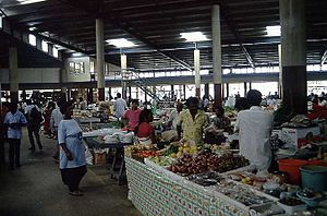
Sights in Lautoka are the market, the Jame mosque , the Sikh temple, the Sri Krishna Kaliya temple and a botanical garden .
There are bus connections to Suva and Nadi . Ships go to the Yasawas as well as Beachcomber Island and Treasure Island.
history
The area around Lautoka first appeared on May 7, 1789, when Captain William Bligh of HMS Bounty sighted and mapped the coast here after a mutiny. In 1929 it was recognized as a city, and on February 25, 1977 it received city status.
Well-known sons and daughters
- Vijay Singh (* 1963), professional golfer
Individual evidence
- ↑ Fiji Islands Bureau of Statistics: Census 2007 Results: Population size, growth, structure and distribution , 2008, p. 33. ( Memento of the original from September 9, 2015 in the Internet Archive ) Info: The archive link was automatically inserted and has not yet been checked . Please check the original and archive link according to the instructions and then remove this notice. In: Statistical News , No. 45, 2008 (PDF; 322 kB). Retrieved August 6, 2015.

