
Lebanese border crossings to neighboring countries
._Nakura._The_gateway_to_Palestine._British_frontier_post_on_the_seacoast_LOC_matpc.00222.jpg)
This is a list of Lebanese border crossings . The Lebanon borders Syria and Israel . Due to the political tensions between Lebanon and Israel since the Lebanon War in 2006, there are currently no border crossings open to traffic between the two states.
Historical situation
The border between the Syrian Arab Republic and the Lebanese Republic extends over a total of about 375 kilometers. This makes up most of the land border of Lebanon; there is also the approx. 70 km long border with Israel in the south. The border was created in 1920 under the French mandate for Syria and Lebanon , with the establishment of Greater Lebanon (the "Greater Area" which indicates the expansion of the territory of the Ottoman Mutesarriflik Mount Lebanon ). Due to the history of Syria’s political engagement in Lebanon since the 1970s, the border was never officially set precisely despite the Lebanese demands in this regard, and the delimitation of the border on Syrian and Lebanese maps shows considerable discrepancies in detail. The village of Deir El Aachayer (west of Damascus) is an example of an area claimed by both countries on their respective official maps.
The Rosh HaNikra crossing was used twice during the negotiations between Israel and Hezbollah. On July 16, 2008, Israel used it to send Samir Kuntar back to Lebanon and to return the bodies of Israeli soldiers Eldad Regev and Ehud Goldwasser for Hezbollah. Following the release of passengers and crew from the flotilla attack in the Gaza Strip, Israel deported four Lebanese activists across the crossing on June 3, 2010.
There are currently three border crossings open to traffic, Arida (Arabic العريضة) and Aaboudiye (العبود) in the north and Masnaa (المصنع) in the east.
Road and path crossings
| Border crossing | Governorate | Neighboring country | Place in the neighboring country | Type of transition | Particularities) | Coordinates |
|---|---|---|---|---|---|---|
| Arida | Akkar Governorate | Syria | Hamidiya | Road (Minieh-Arida Highway) | Motorway between Tartus and Tripoli | 34 ° 22 '48.9 " S , 35 ° 23" 0.5 " W. |
| Aaboudiye | Akkar Governorate | Syria | Dabousiya (Dabousieh) | State Road 51 (Mqaitaa-Addabousiya Highway) | 34 ° 22 ′ 55.3 " S , 36 ° 4 ′ 15.3" W. | |
| Al Kibir river | Akkar Governorate | Syria | Tell Kalach | Road from the Lebanese border to Tell Kalach | closed (former connection road from Homs to Tell Kallach) | 34 ° 24 ′ 1.7 ″ S , 36 ° 10 ′ 52.2 ″ W. |
| Chadra | Akkar Governorate | Syria | Hadida | Road from Qoubaiyat to Homs | closed (road from Qoubaiyat (Lebanon) to Homs in Syria) | 34 ° 23 ′ 41.6 ″ S , 36 ° 12 ′ 20.7 ″ W. |
| Mrah Chehab | Akkar Governorate | Syria | Al Fadilijja | Road from Mazraat El Talleh to the Syrian border | closed | 34 ° 18 ′ 3 ″ S , 36 ° 14 ′ 41.3 ″ W. |
| Qaa | Baalbek-Hermel Governorate | Syria | ousseh or Al-Nizariyah | Baalbek Qua Highway | Connecting road from Baalbek to Homs; open again since 2017 | 34 ° 15 ′ 6.6 ″ S , 36 ° 19 ′ 24.8 ″ W. |
| Ham | Bekaa Governorate | Syria | Serghaya | closed | 33 ° 30 ′ 7.3 ″ S , 36 ° 6 ′ 16 ″ W. | |
| Masnaa | Bekaa Governorate | Syria | Jdaidit Yabws (Jdeidat Yabous) | State road 30 from Beirut via Majdal Anjar to Damascus | The border crossing has been closed many times in its history and has been a continuing subject of controversy, largely due to its role in hostilities in the Middle East. The last time a US security delegation visited the crossing was on April 29, 2010, which worried the Lebanese government and the Hezbollah fighters operating from Lebanon . | 33 ° 24 ′ 10.2 " S , 35 ° 34 ′ 31" W. |
| Kafr Kila ("Fatima Gate") | Nabatea Governorate | Israel | Metulla | closed. Junction at Marjaayoun-Bint Jberil Road to Metulla | After the end of the Israeli occupation in the so-called security zone , which lasted from 1978 to May 2000, the last Israeli soldiers withdrew through the Fatima gate on the Israeli-Lebanese border. | 33 ° 9 '43.7 " S , 35 ° 20" 5.9 " W. |
| Naqura | South Lebanon Governorate | Israel | Rosh HaNikra | closed | North of Nahariya is the Israeli-Lebanese border, guarded by an Israeli outpost at the top of a white cliff called Rosh-Hanikra. | 33 ° 3 '14.2 " S , 35 ° 3' 42.3" W. |
railroad
As long as there was rail traffic in Lebanon , there were also border crossing points. However, these were given up in the course of time when the railway traffic to Israel was stopped for political reasons or when the corresponding routes were given up.
| Border crossing | Governorate | Neighboring country | Place in the neighboring country | Railway line | Particularities) | Coordinates |
|---|---|---|---|---|---|---|
| Tall Abbas | Syria | Akkar | Tripoli – Homs railway line ( standard gauge , 1435 mm) | In operation: 1911–1975? | ||
| Ras Baalbek | Syria | Qaa | Rayak – Homs railway line (standard gauge, 1435 mm) | In operation: 1906–1975? | ||
| Jachfufa | Syria | Jisr Remani | Lebanon Railway ( narrow gauge , 1050 mm) | In operation: 1895–1975? | ||
| Naqura -Frontière | Israel | Rosh HaNikra | Haifa – Beirut – Tripoli railway line (standard gauge, 1435 mm) | In operation: 1942–1948? The border here runs in a tunnel |
gallery

Israeli and Lebanese flags at the "Fatima Gate" border crossing between the two countries during the First Lebanon War in 1982

The “Fatima Gate” in 2016

The "Fatima Gate" around 2009

Israeli-Lebanese border at Rosh Hanikra (2005)

Israeli-Lebanese border crossing at Rosh Hanikra (2015)
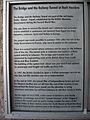
Information board in Rosh HaNikra about the tunnel and border crossing


Web links
- Sunniva Rose: All official Syrian-Lebanon border crossings now open. Al Monitor, December 17, 2017, accessed March 3, 2020 .
- Amreesha Jagarnathsingh: Lebanon SupportLebanon's Border Regime: Fluid Rigidity, Foreign Interference, and Hybrid Security Assemblages. Diva Portal, July 22, 2019, accessed on March 1, 2020 .
Individual evidence
- ↑ Lebanese aboard Flotilla welcomed home as heroes. Ya Libnan, June 2, 2010, accessed March 3, 2020 .
- ↑ Border crossing between Lebanon and Syria reopens in Arab News (2017)
- ↑ Visit by US delegation to border area causes confusion. Yalibman, April 29, 2010, accessed March 2, 2020 .
- ↑ See Night Draws Near: Iraq's People in the Shadow of America's War by Anthony Shadid (2006)
- ↑ See Israel Guide by Zev Vilnay. Agency: Ahiever, 1958
- ↑ Information from: Neil Robinson: World Rail Atlas and historical summary. Volume 8: The Middle East and Caucasus. World Rail Atlas, London 2006, ISBN 954-12-0128-8 , plates 16 and 17.